
MARCH 22 : Friday we had a scenic three-hour drive from Cradle Lake to Lake St. Clair. It took us all day. Both lakes are in the Cradle Lake – Lake St. Clair National Park, one at the north end and the other at the south. There are no roads through the park (only a 7-day overland trek from one end to other, which we were not doing), so we drove south on a scenic road on the outskirts of the park.
It rained all day. Sometimes it poured, sometimes it drizzled, occasionally the sun would come out and disappear three minutes later. It was a very wet day.
We left Cradle Lake at 10:30 (it is still taking us a long time to get ready to move out in the morning) and drove 10 minutes when we saw a sign for a lookout. We stop at every lookout sign we see along the way. After climbing a big hill (Mark’s smartwatch said we had climbed 8 flights of stairs), we came to an overlook of a beautiful valley – the Vale of Belvoir. We did not stay long – the wind and rain made it hard to be outside. We started a list of what to take when going out – and added hat and gloves to the list.
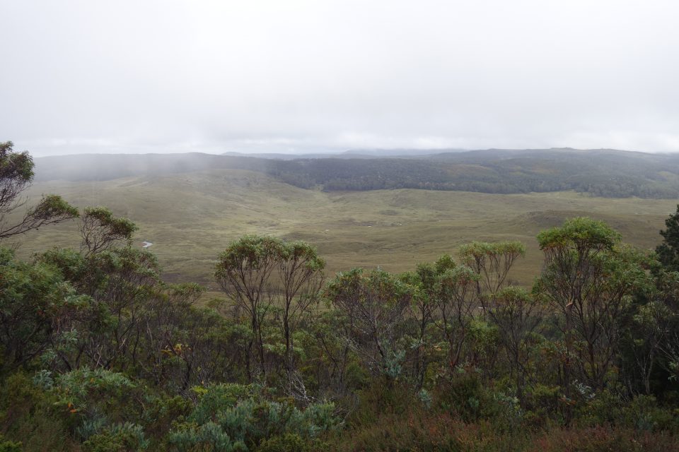
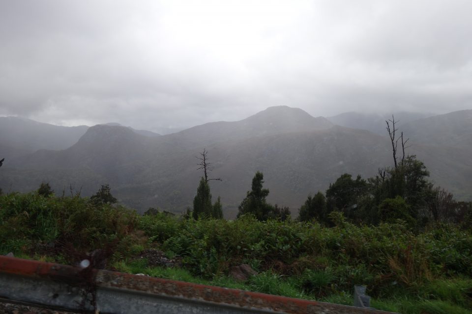
As we drove along, the scenery alternated between meadows and forest (mostly forest). There were always mountains in the background, but the mountain tops were covered in rain clouds. I feel we saw only the bottom 2/3s of the scenery, the top third was hidden away. It was beautiful none the less. Along the way we passed little waterfalls, lakes, and always, many, many trees.
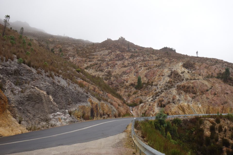
Our next stop was Queenstown. The hills around the town looked like nothing we had seen before. They were bare of green growth, and the rocks and dirt were a brown, gold, beige and orange color. It was unusual. Some of the mountains in the area looked to be chopped away from mining. Turns out that Queenstown used to be a major copper mining town.
In Queenstown, Mark did the grocery shopping and I kept social-distancing in the campervan (meaning I spent the time organizing the thousand tourist booklets we picked up along the way). We need to grocery shop often because of the limited amount of room in the cabinets and fridge. Grocery shopping still takes a long time because we are still learning which brands are kosher. When we want to get something for the first time, Mark uses the Kosher Australia app on his phone – it lists all Kosher products. So shopping takes some time while till Mark checks if the brand is okay, and if not, to find one that is. As we become familiar with the list, it will go faster.
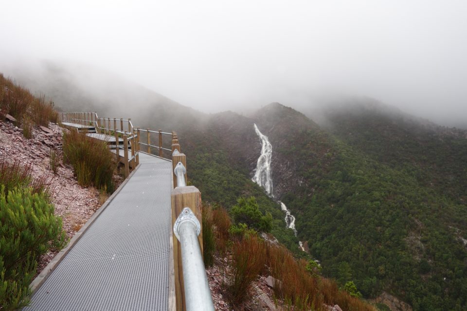
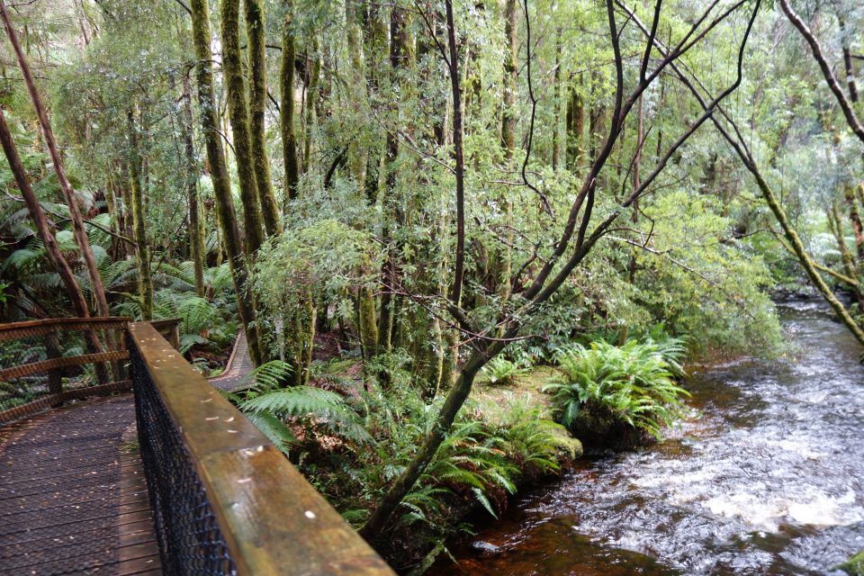
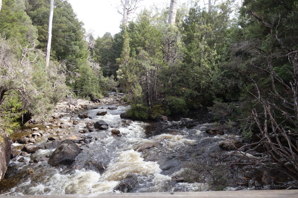
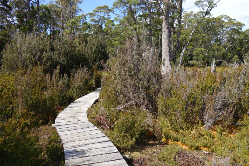
From Queenstown, we climbed up over the mountains, and came upon a raging waterfall and noticed there was a boardwalk on the side of the mountain leading up to the falls. We stopped and climbed to get a closer look at Horsetail Falls. Once again it was very very windy, raining and cold. We got closer to the falls, took a few photos and returned to the warmth of the campervan.
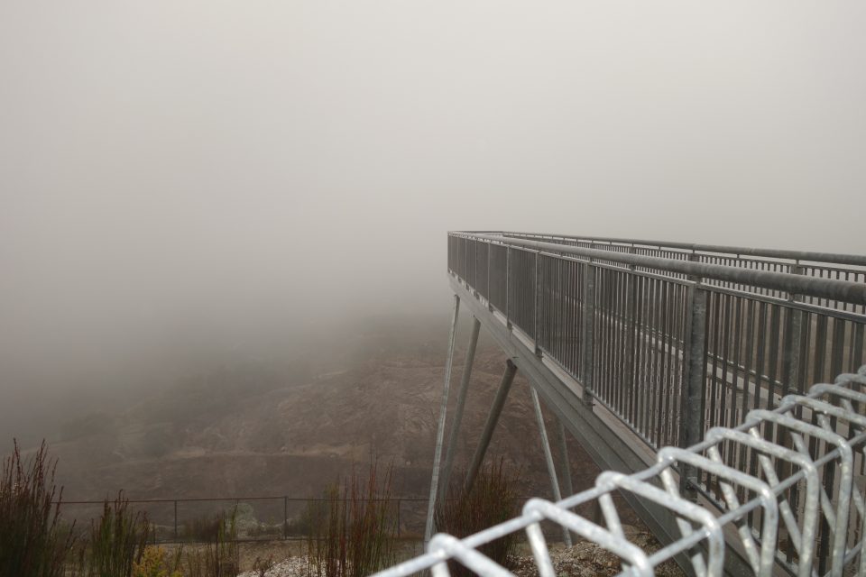
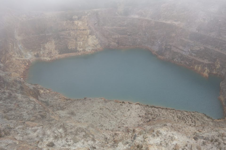
Across the street was a sign to the Iron Blow lookout. It was a short drive up a hill, but as we approached the top we went into the clouds. It seemed that there would be nothing to see at the top. However, the Iron Blow is a lake sitting in a volcano crater. When you went out on the viewing platform, surrounded by clouds, visibility low, and you looked down – there it was. A beautiful blue lake inside a volcano crater. The crater was made of the gold-brown-orange colors of the surrounding mountains. A nice surprise.
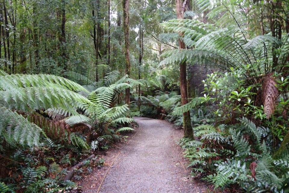
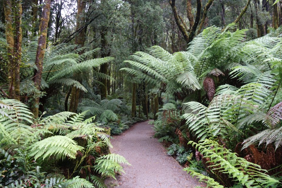
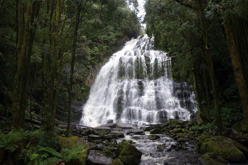
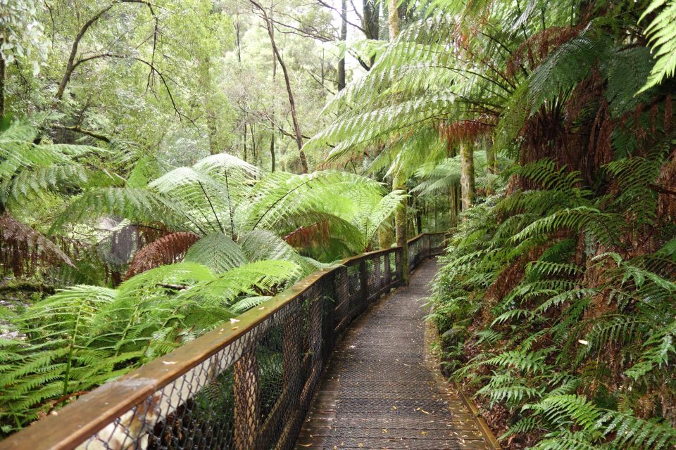
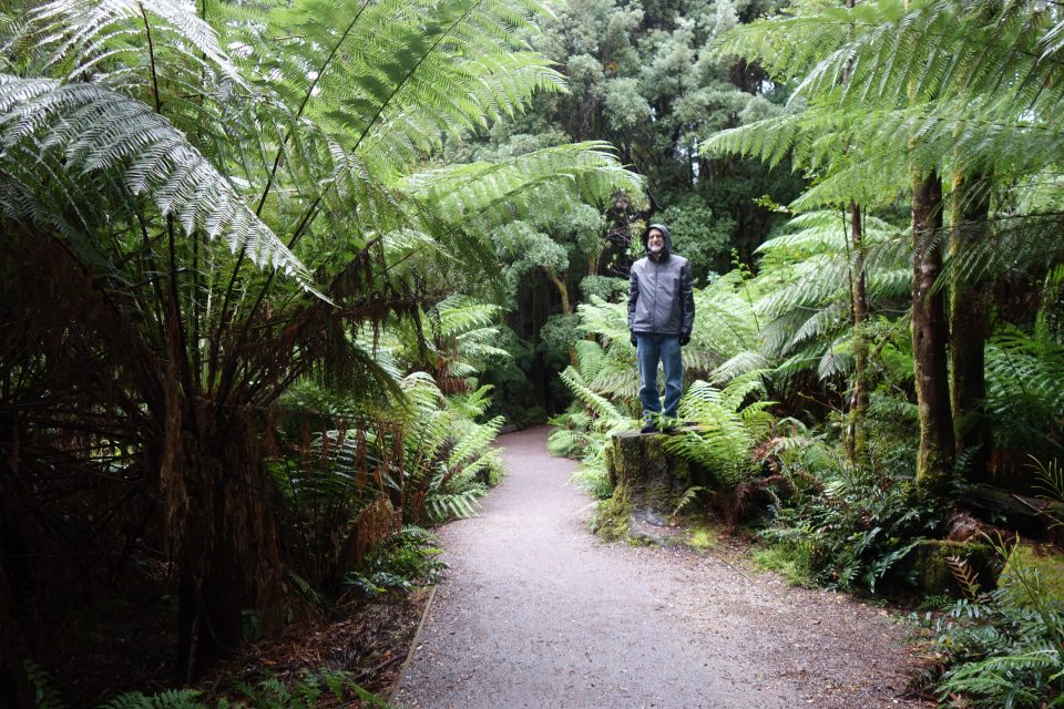
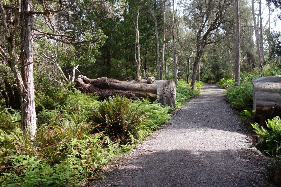
We continued driving until we reached Nelson Falls. Right before the Falls we had crossed into Franklin Gordon National Park (yes to get from one end to the other end of the same park, you cross into a different park – 40% of all Tasmania is National Parks and Reserves – and there are many of them, so it is not unusual to go through more than one in a day) Nelson Falls is absolutely enchanting. It is a short 10-minute walk from the carpark to the falls. You walk through an amazing rainforest with huge, gigantic, massive ferns everywhere. It is lush, it is green, it is amazing. From the start you hear the falls, but do not see them. All of a sudden, as you round a corner they appear. A beautiful tall and wide cascade of water.
The day was getting late – Shabbat would be starting soon and we still needed to reach our destination and cook and prepare. We reached Lake St. Clair, registered, went to our campsite and made Shabbat.
Tomorrow we will explore the area.
Shabbat morning. We woke up to sunshine! After it rained all day yesterday, seeing the sun shine was happiness.
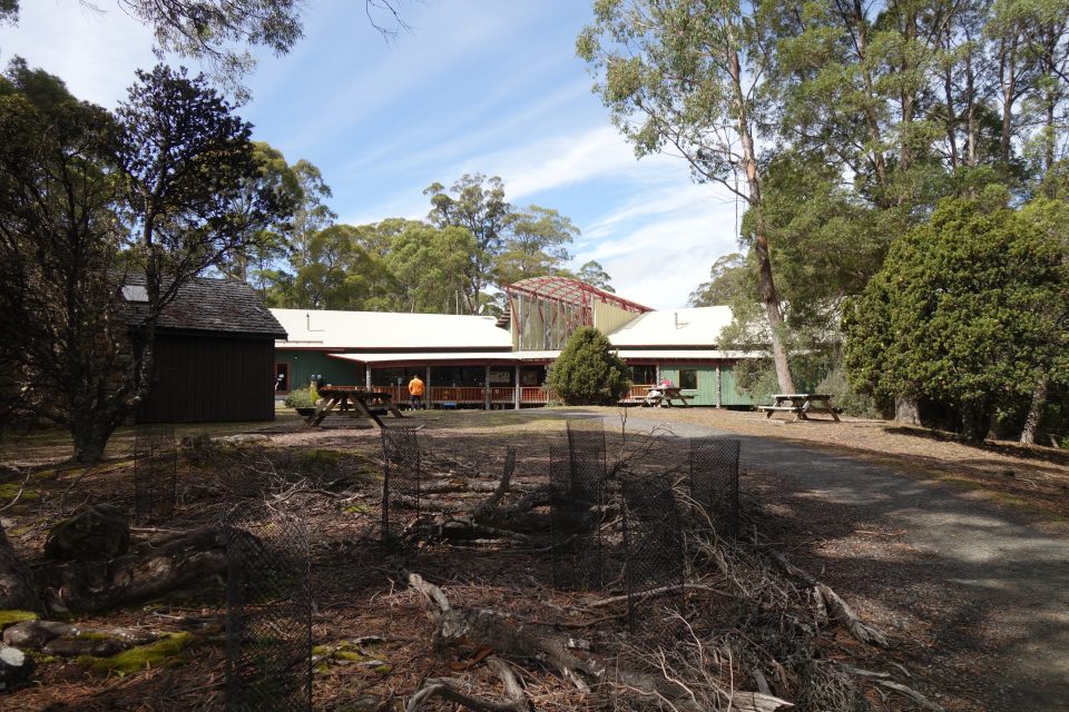
We had not yet seen the lake, so after kiddush we went to the Visitor Center and learned about the day hikes in the Lake St. Clair area.
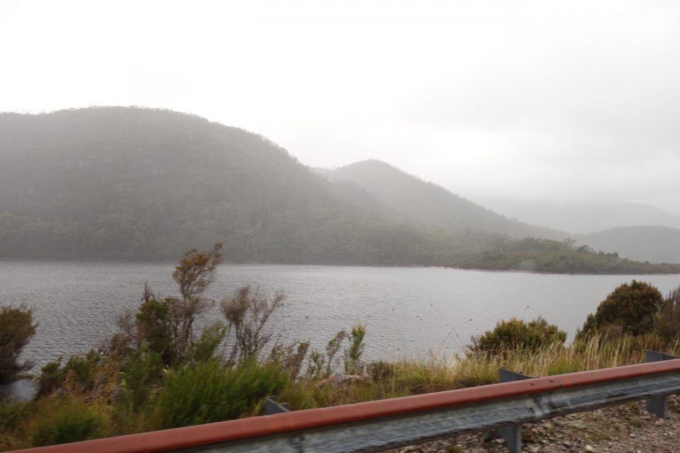
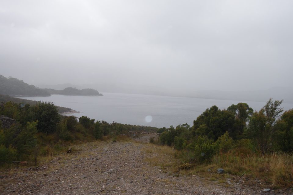
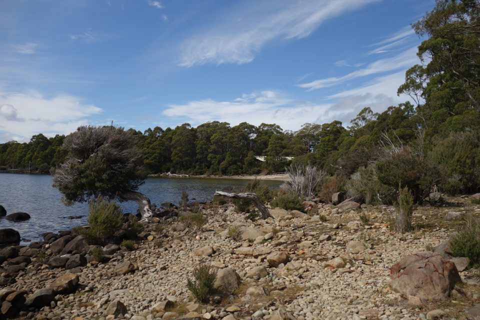
Lake St. Clair is the deepest lake in all of Australia. It was created by glaciers many years ago. The lake is a deep blue and is surrounded by forest as far as one can see.
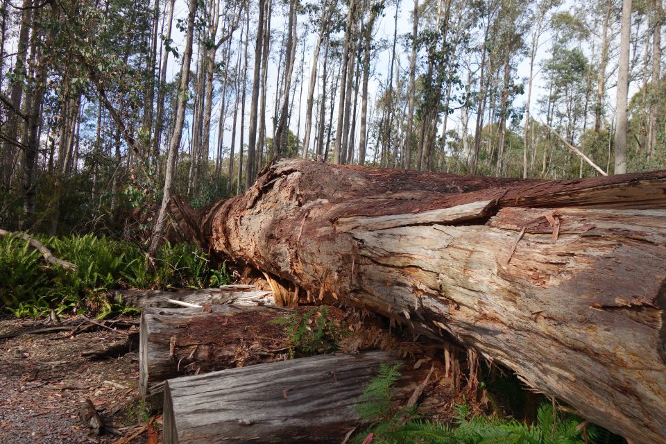
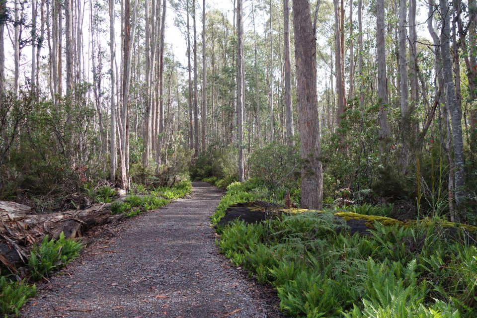
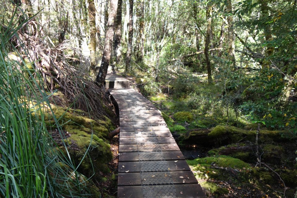
After going to the visitor’s center, we started walking (on Shabbat it is called walking, during the week it is hiking) on the Watersmeet track. It is a easy level walk to a place where two rivers meet – that is why it is called Watersmeet. We walked in a forest with many huge trees lying dead on the ground. There was a fire in this area in 1965 and these huge old eucalyptus trees were destroyed in the fire. The forest we walked through was all new growth since 1965.
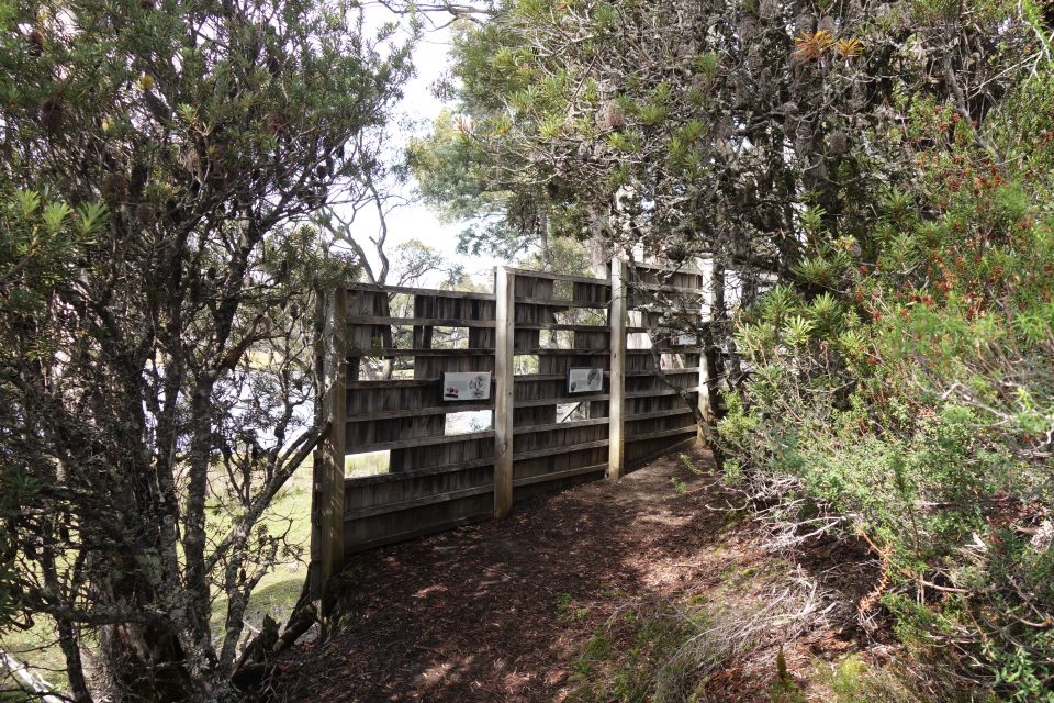
From the end of the Watersmeet trail – at a bridge overlooking the joining of the two rivers – we continued to the Platypus Bay circuit. On this circuit are viewing stations that overlook Platypus Bay, home to several platypus. The viewing stations are basically wooden walls with some planks removed for you to stand behind. The wall hides you from the platypus, but through the holes in the planks, you can still see out. It was already too late in the day for the platypus to be seen, and we stood quietly behind the wall and looked but did not see any. There is a notebook at the visitor’s center that if you see a platypus, you write a comment in the notebook. The last time a platypus was sighted was two days ago.
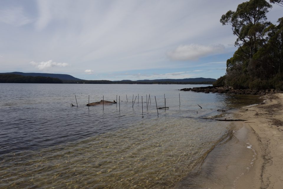
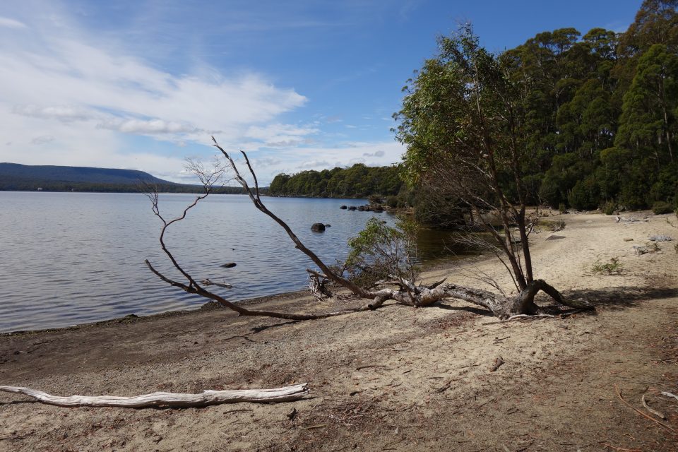
From there the trail took us down to a small sandy beach on the lake. We enjoyed sitting in the sunshine and admiring the beautiful view. On the beach were the remains of a barge that sank in 1935. The barge had been caring supplies for a pump station that was being built across the lake. The hydro-electric station was never finished, and today the buildings have been converted to a hotel retreat.
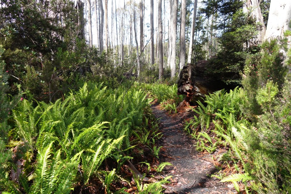
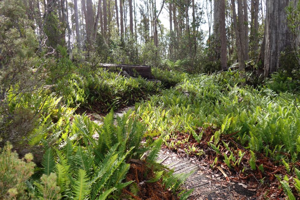
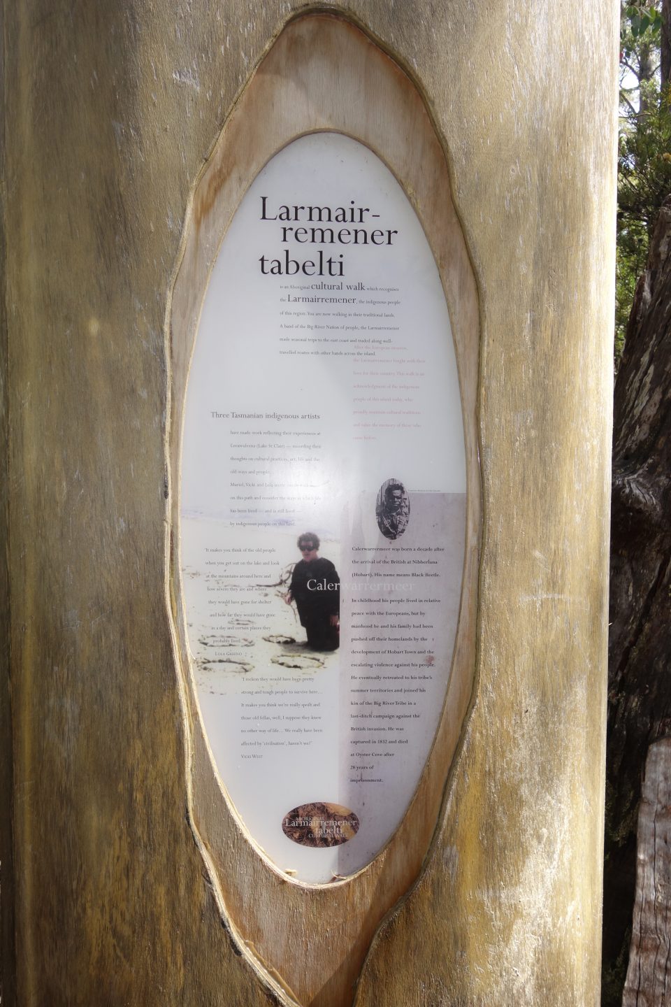
From there we completed the circuit and returned to the Watersmeet bridge. Instead of returning to the visitor center along the same trail, we took the Larmairremener tabelti Aboriginal cultural walk. This was a parallel route, but much more up and down than the way we came. Along the way there were a few signposts detailing the relationship of the land to original aboriginal tribe that lived there. At first, the native tribe got along with the Europeans, but eventually not. When there were only 25 members of the tribe left, they surrendered with the promise that that would be able to return to their lands. Instead, they were shipped off to Flinders Island, a small island off the coast of Tasmania.
Once we finished the Aboriginal Track, we went down to the lake and followed the rocky coast back to the visitor center.
The rest of the day was lunch, then a 500-piece puzzle. That is the largest size that fits on the campervan table. Bummer.
The Lake St. Clair area is not as popular as Cradle Mountain. There were fewer people here, and the campground was more primitive. There was no wifi, and phone reception was too weak to create a hotspot. We were really in the wild. Wonderful!
Today, before we left Lake St. Clair, we returned to the visitor center only to discover that it was closed. Last night the Tasmanian government gave the order to close all visitor centers. We rely on the visitor centers to get maps for our hikes and information about the area. This is starting to get worrisome.
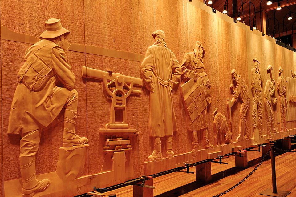
Our first stop was The Wall in the Wilderness. This is a work in progress by artist Greg Duncan that was started 15 years ago and is still being worked on. It is a 100 meter long wooden mural depicting Tasmanian history. The artist’s opinions come through. For example, the first part depicts the native Aboriginal people who lived in Tasmania and has two panels. The first panel is just a series of barefoot footprints in the sand. The second is the same footprints but with a chain and collar next to them. That says it all. Another part of the wall had the tally of all the Tasmanian tigers killed by the local Pearce family in the late 1800’s. It had the name of the Pearce family member, the date, and the number of tigers he killed on that day. The total over the years was 77. Today the Tasmanian tiger is extinct.
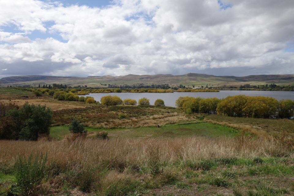
From there we began our drive to Mt Field National Park, about two hours away. We stopped along the road for breakfast with a beautiful view of grazing fields with cows and sheep and golden rolling hills in the background. We then stopped at a free campsite for lunch. There is a whole network of free campsites in Australia. They are usually located in stunning places – as was this one with a view of a lake surrounded by trees whose leaves had turned a vibrant yellow. Quite beautiful. These campsites are usually a large grassy lot with bathroom facilities. Sometimes they also have a kitchen. We do not stay at them because we like to be plugged into electricity at night – otherwise we have no heating and it is cold – even with the heating.
We arrived at Mt Field National Park and as expected, the visitor center was closed. However, the park rangers had set up a table in front of the entrance and answered questions while keeping their distance. They had maps available for all the hikes we would like to do tomorrow.
We then went to check into our campsite. The plan was to stay here for the next three nights. The camp manager told us we can only stay for one night – the Tasmanian government informed him that they will be deliberating tonight about the closing of all the National Parks. Tomorrow morning we should know more.
Our trip was basically moving from one National Park to another – if the parks are closed, not sure what we will do. Looking into coming home.
Stay tuned.
nice you are enjoying the wilderness even in the rain.
so sad if you will have to come home so soon 🙁
Sorry to hear your plans may be cut short ☹️. Man plans and God laughs.
We were hoping you were deep enough into the wilderness to escape problems with corona! Take care of yourselves!