JUNE 1, 2024: We woke up this morning, parked in a campground that was once a pier, and our motorhome is facing the water. The water is moving and lapping against the stones. When looking out the front window, the motion and the sound of the water make us feel like we are on a boat.
After our usual Saturday morning routine (morning prayers and kiddush), we went for a walk to the town of Stromness nearby. The sun was not out, but at least it was not raining.
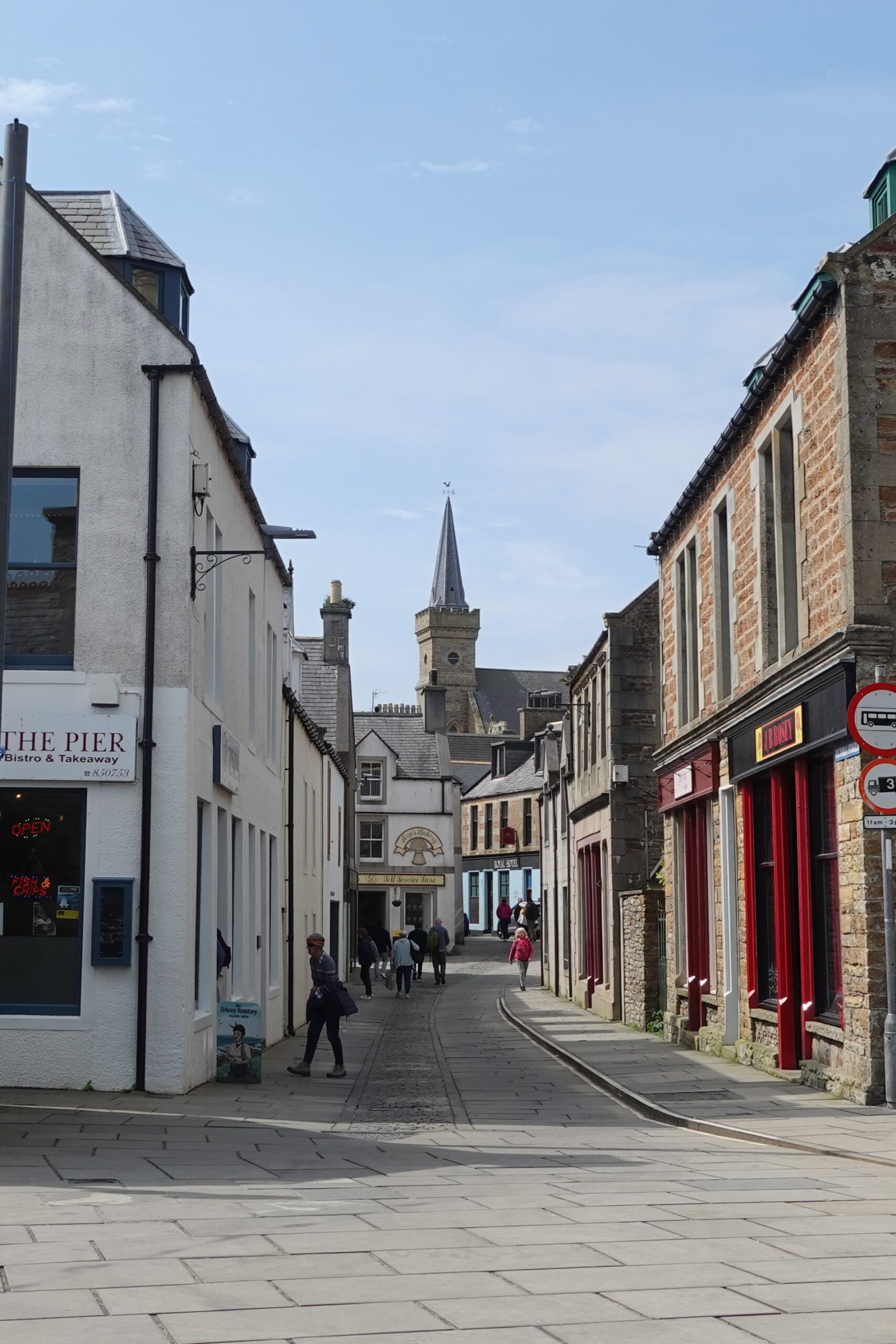
When we reserved our place at the campground, we were told not to follow Google Maps and not to attempt to drive the motorhome through the main street of the town. Now I understand why.
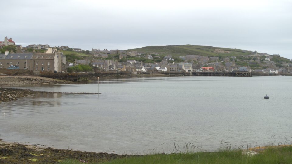
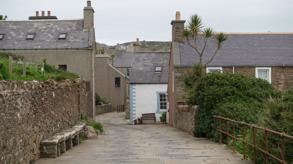
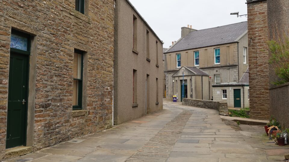
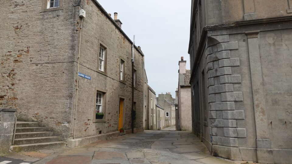
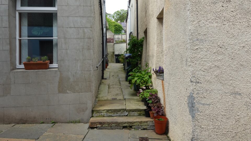
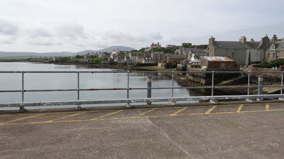
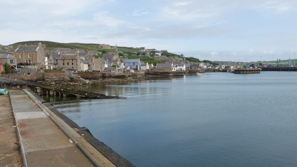
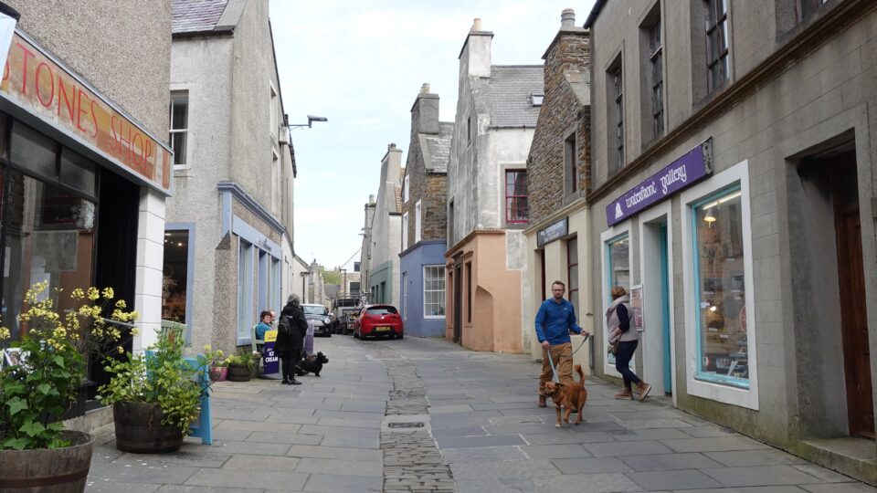
The main road in Stromness is a very narrow, picturesque, flagstone street, with old stone buildings lining it on both sides. The town is hemmed in by a steep hill on one side and the sea on the other. From this main street, lanes lead up the hill or down to the water.

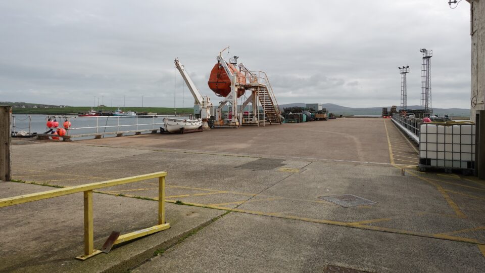
Stromness has a maritime history spanning hundreds of years, and still has 20 piers and jetties.
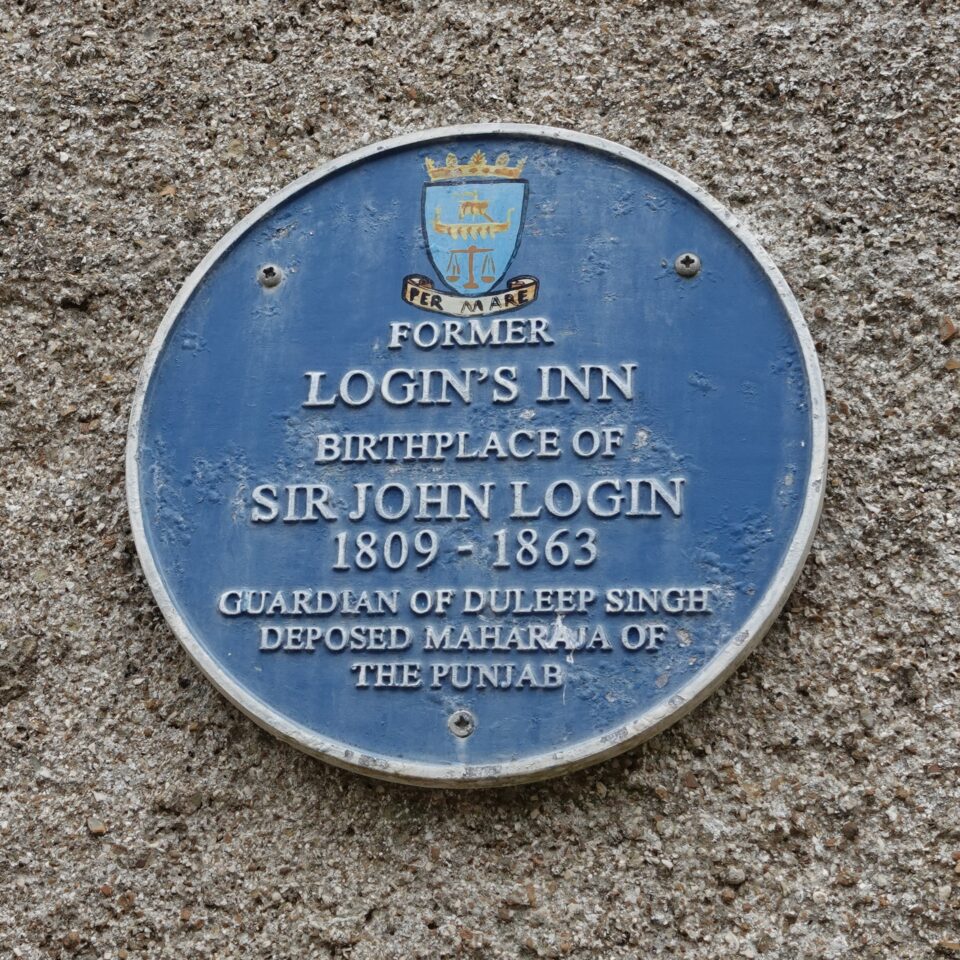
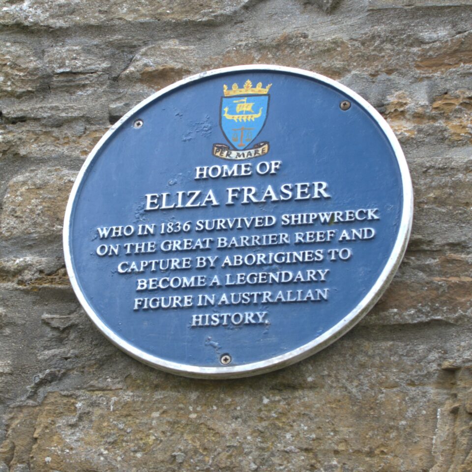
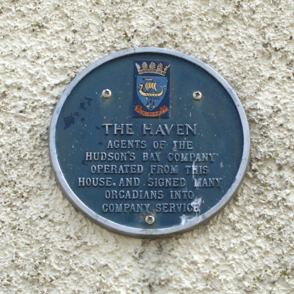
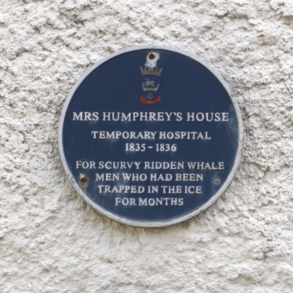
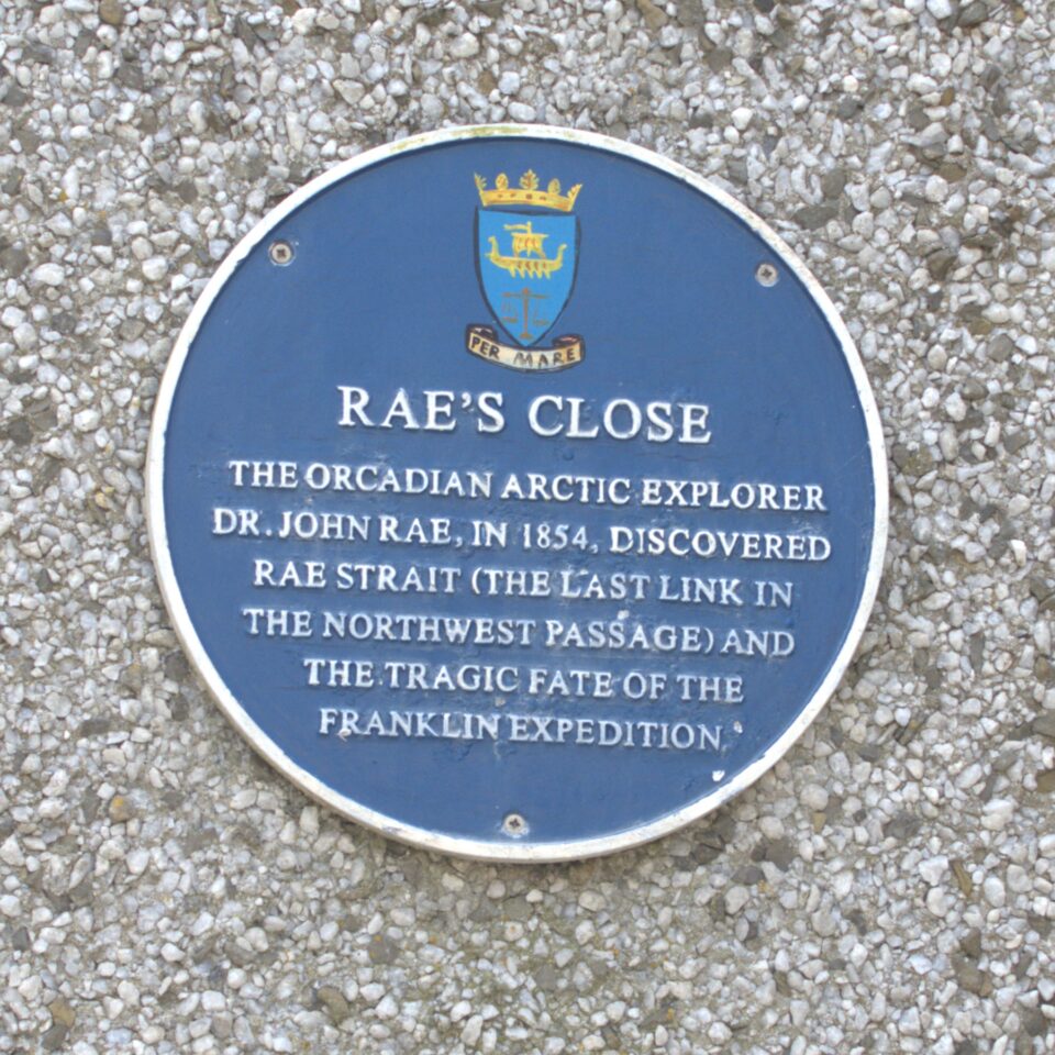
Blue plaques can be found throughout the street highlighting buildings and stories of interest. Today Stromness has a population of approximately 2,000 residents. What I found especially interesting is that from such a small, off the beaten path place, people from here played important roles in the history of very far away places. From the blue plaques we saw mentioned the Hudson Bay company in Canada, Sir John Login in India, Eliza Fraser in Australia, and Dr. John Rae in the Artic.
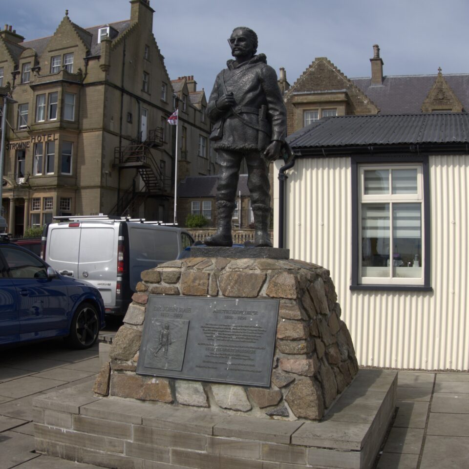
In addition to a blue plaque on his house, Dr. John Rae also has a statue in the harbor. He was an Arctic Explorer who lived between 1813 and 1892. Despite discovering new passages though wild places, he never received the same recognition for his achievements as other Arctic Explorers. This was because Rae discovered the fate of the Franklin Expedition, concluding that the missing sailors had been forced to resort to cannibalism. The British establishment condemned Rae’s findings and questioned his integrity. In 2013, Stromness celebrated Dr John Rae’s 200th birth date by unveiling this statue.
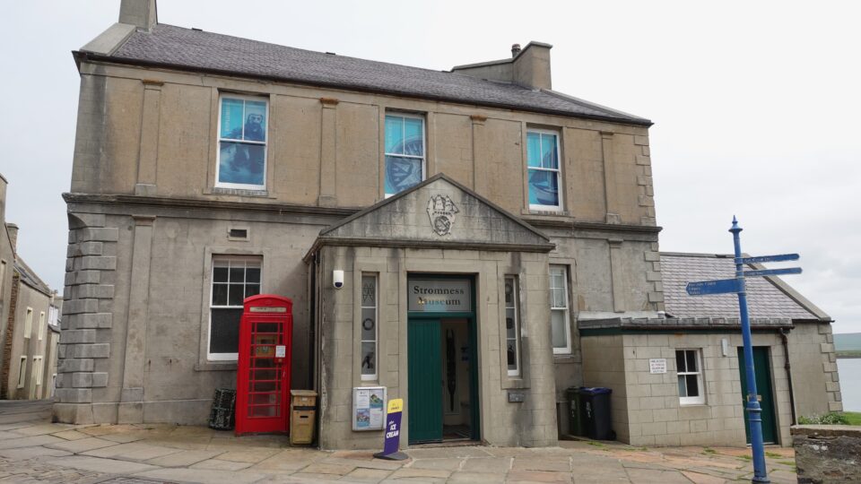
On the main street is also the Stromness Museum, which tells the tale of the town. Being Shabbat, we did not have any money with us to pay the entrance fee and could not enter. Next to the entrance of the museum, is an old red phone booth. Today it is used to house a defibrillator.
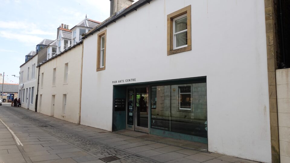
The other main tourist attraction in Stromness is the Pier Art Center, an art gallery and museum.
The first part of the main street was residential. Towards the ferry terminal, it became more commercial, with restaurants, gift shops, etc.
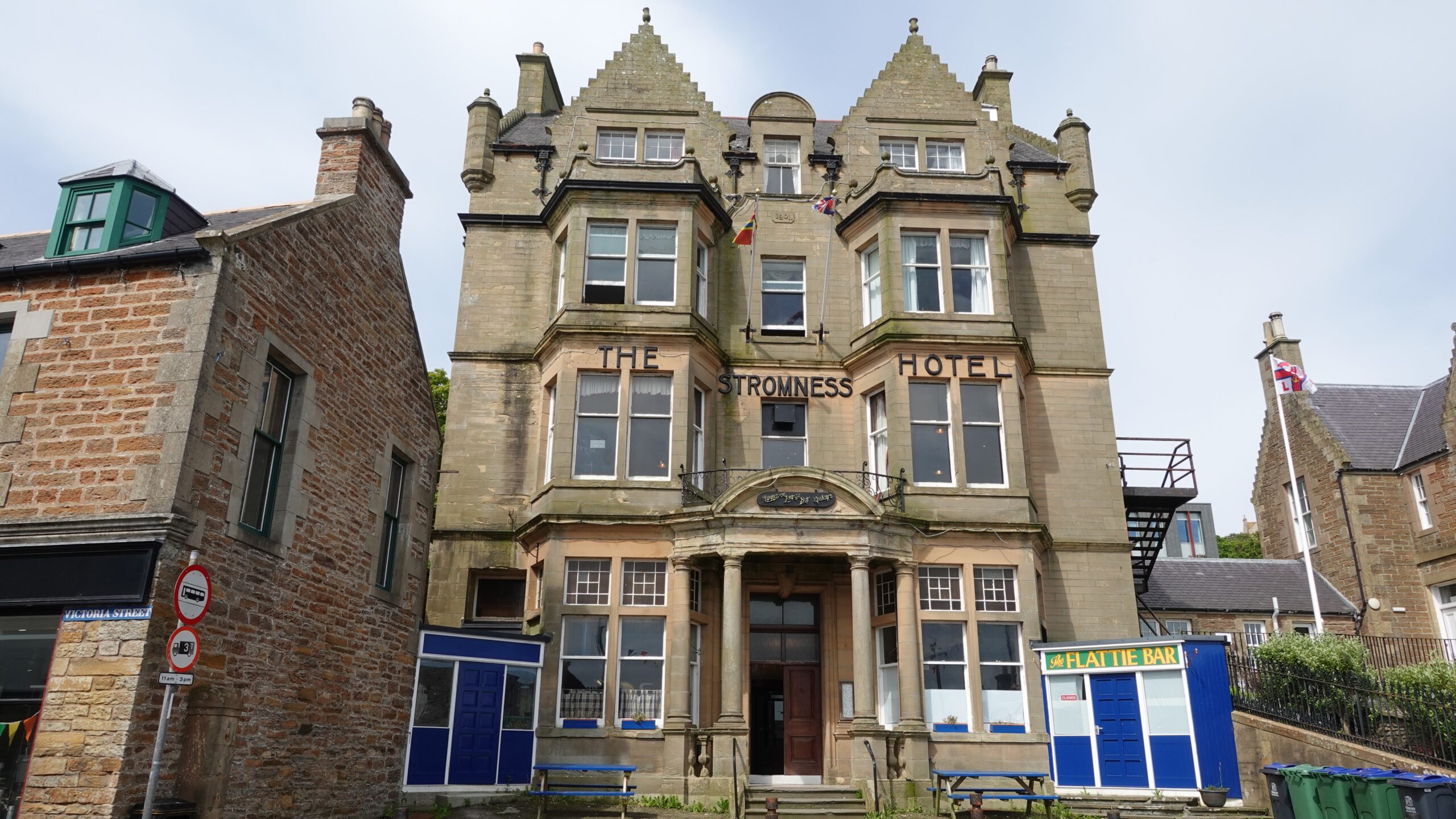
Some of the older buildings near the port had the dates they were built on them – the hotel for example, had a date stone from1901. Two buildings further down the street, was a house from1884.
We returned to our campsite, had lunch and our Shabbat rest. The sun came out!
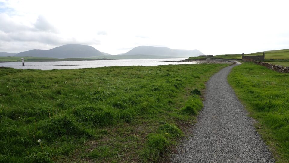
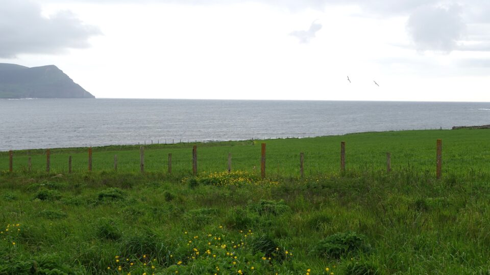
Yesterday, I saw a path next to the shore alongside the golf course behind our campground. We went for an late afternoon walk along this path, which turned out to be much more interesting than expected.
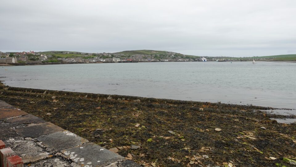
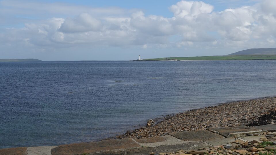
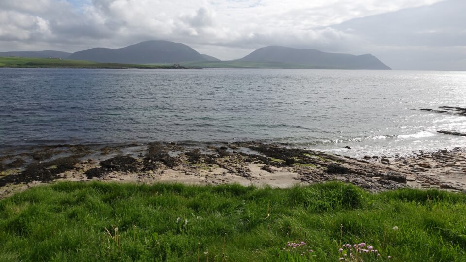
Our campground is situated in the Point of Ness. Facing south, on our left is the western entrance to the Scapa Flow, the natural harbor that was home to the British Navy during both World Wars.
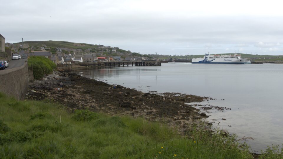
In front of us is Hoy Sound, the narrow strip of water between the Mainland and the island of Hoy.
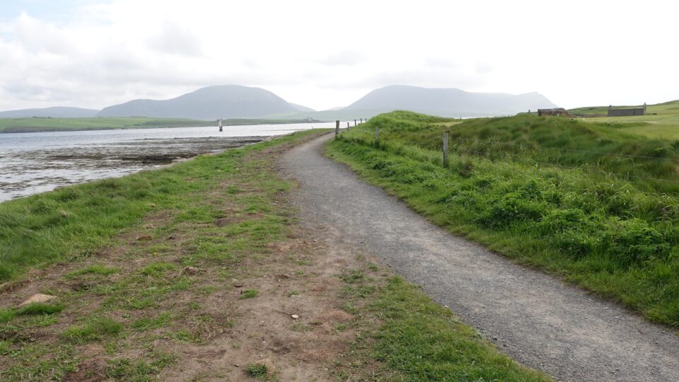
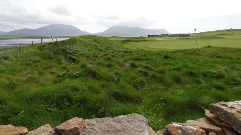
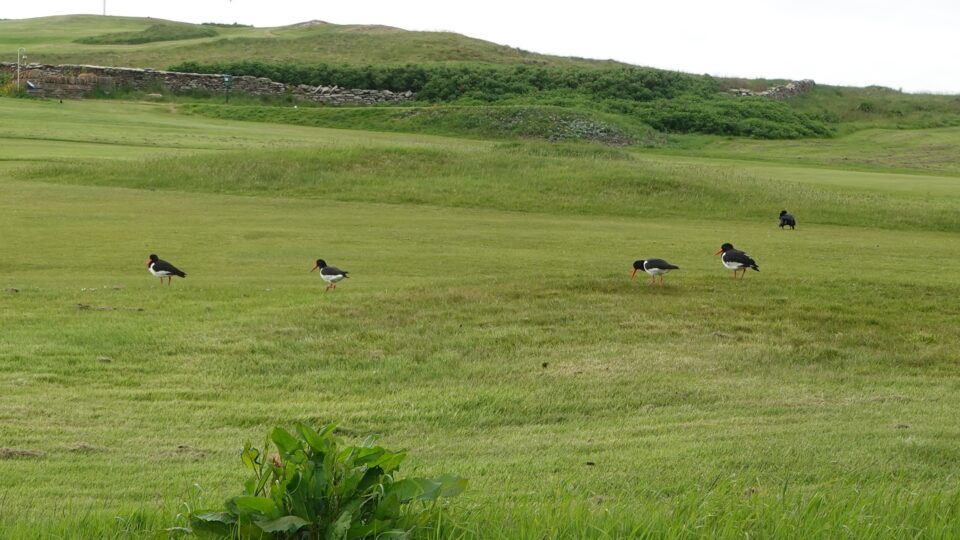
On our right is the Stromness Golf Club which was established in the 1870.The present course was laid out in 1923. It’s 10th hole is called the Battery, and we would soon learn why.
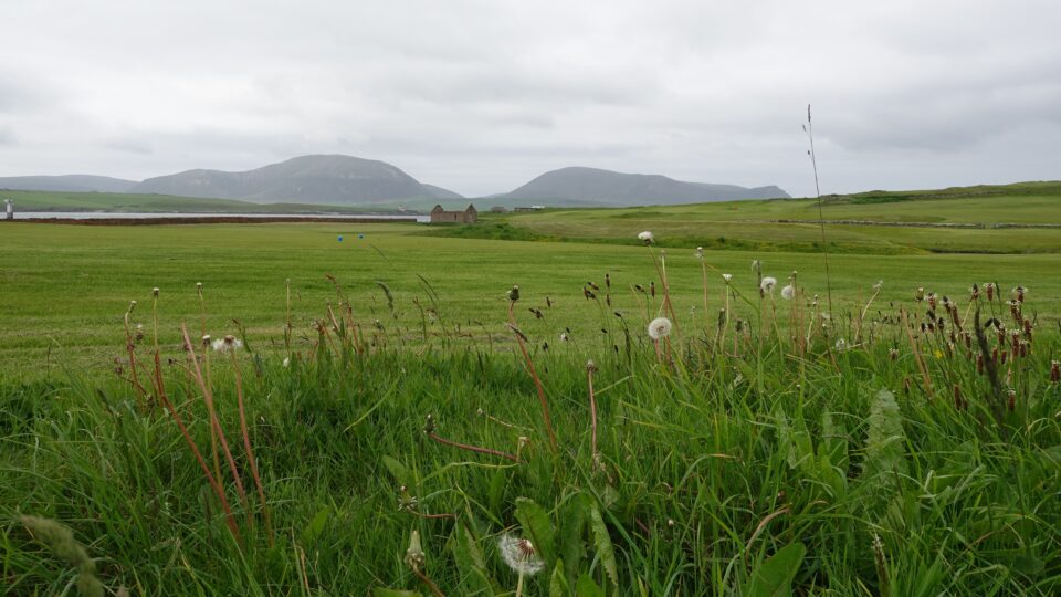
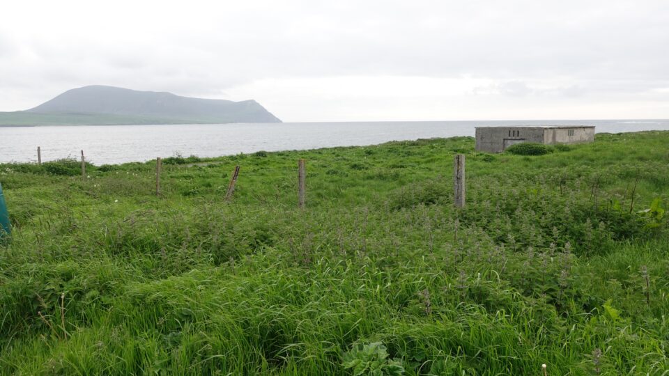
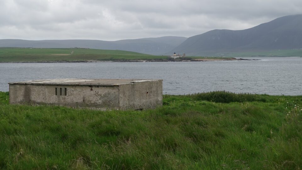
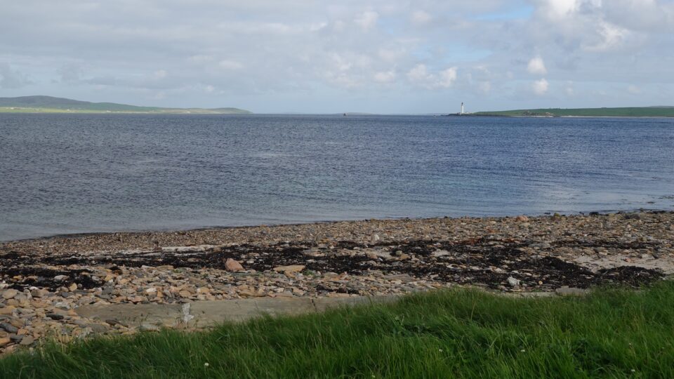
Between us and the high cliffs of Hoy, is the small low-lying island of Graemsay. Graemsay measures a mere two miles wide and has just over 20 inhabitants. The island has two lighthouses to assist safe navigation through the dangerous tides of Hoy Sound.
Both lighthouses on Graemsay were visible from the coastal path. The first to come into sight was the Hoy Sound High Lighthouse.
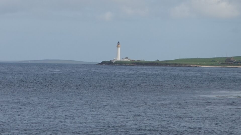
Further down we would see the Hoy Sound Low Lighthouse. It marks the beginning of the main channel into Scapa Flow.
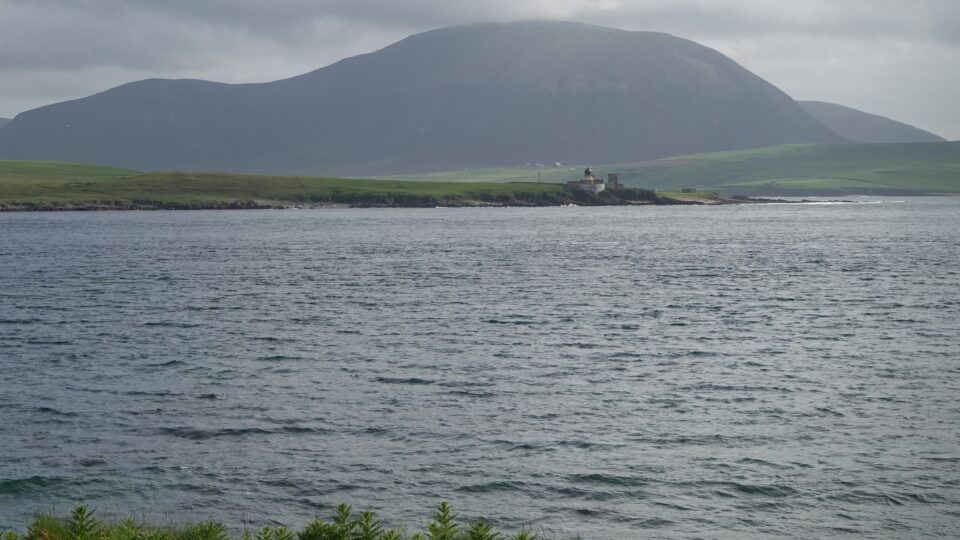
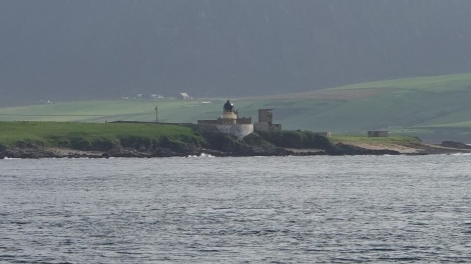
Both lighthouses were designed by Alan Stevenson, from the third generation of famous Stevenson family lighthouse engineers. They were officially lit in 1851. The low lighthouse was automated in 1966, and the high lighthouse in 1978. Both are now private residences.
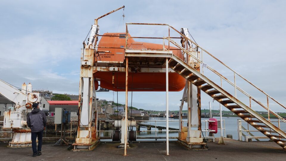
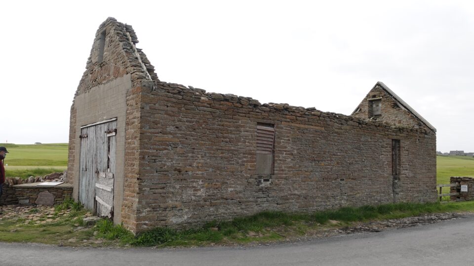
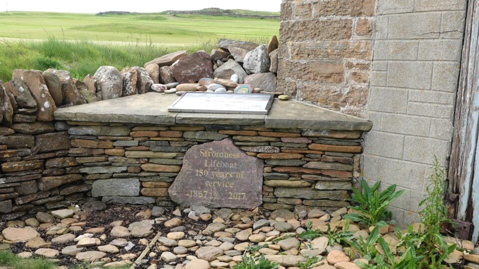
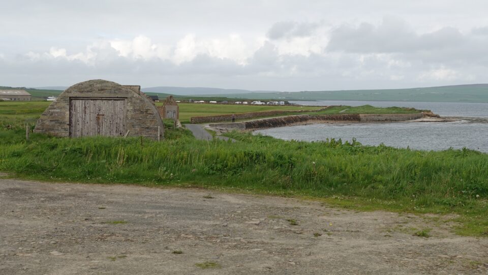
The first historical building we encountered on the walk was the remains of a lifeboat station that operated from here from 1867-1890. Due to the difficulty of launching lifeboats in bad weather, the station was moved to Stromness Harbor in 1890.
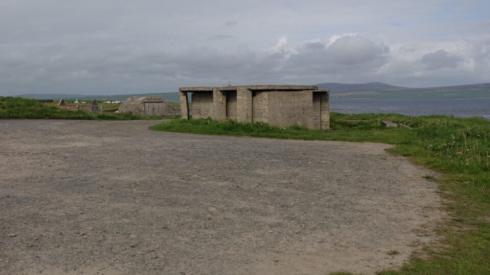
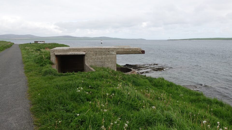
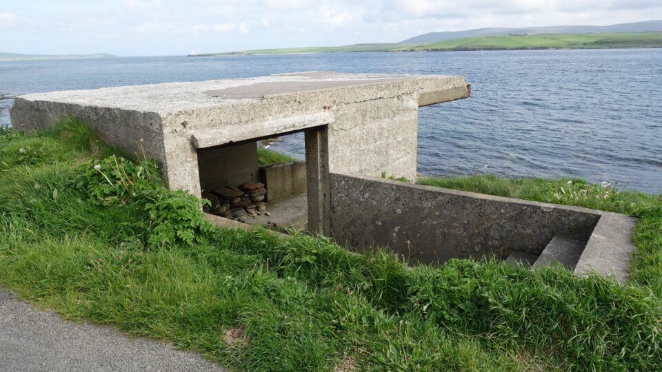
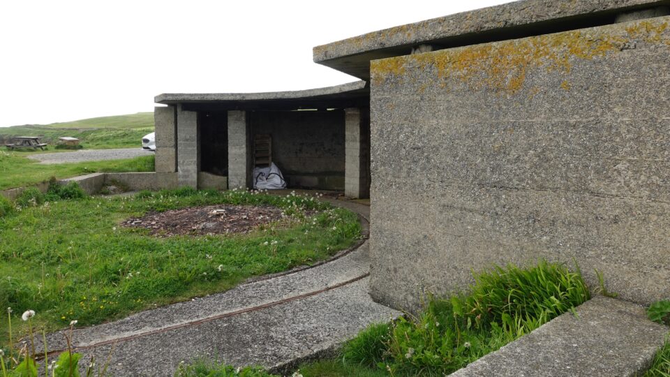
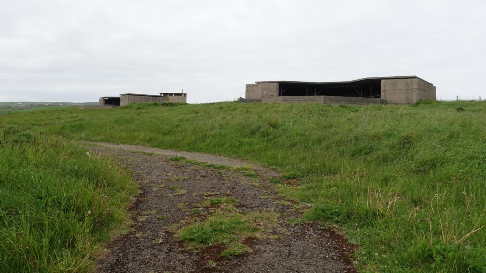
Next we encountered remains of several buildings from WWII. Yesterday, we saw the Churchill Barriers that blocked the eastern entrance to Scapa Flow, where the British navy was stationed. The western entrance in Hoy Sound remained open and needed to be defended.
The coastal path was littered with wartime watchposts and gun batteries.
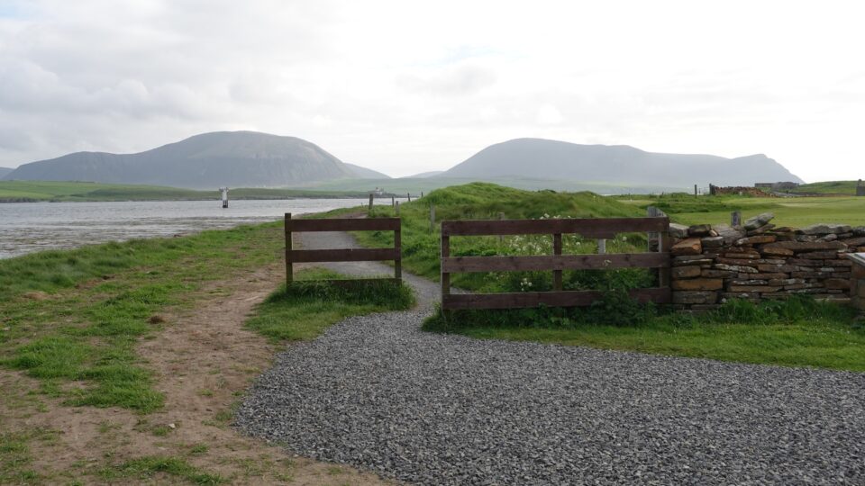
We returned to the campground along the same path, and continued to enjoy the views over the Hoy Sound.
Tomorrow morning we leave the Orkney islands, taking the ferry back to the UK mainland. We greatly enjoyed our time here – seeing the constantly stunning landscape, visiting the neolithic sites on the island, and learning about the import role Orkney played during both World Wars.
Bye Bye Nice Place.
Nice!! Fairy tale villages