MAY 29, 2024: Today we are taking our first UK ferry ride – from the UK mainland to the Orkney Islands! The ferry leaves from Scrabster on the mainland at 13:30. You need to line up to board about an hour before, which still gives us some time this morning to first see a couple of sites.
Before leaving John O’Groats, the village in the northeast corner of the UK mainland, I went to have a look around. John O’ Groats is a spread-out agricultural village with a small village center popular with tourists. There are pubs, cafes, restaurants, gift shops, a tourist information center and a distillery visitor center. Now, early in the morning, everything was still closed and empty.
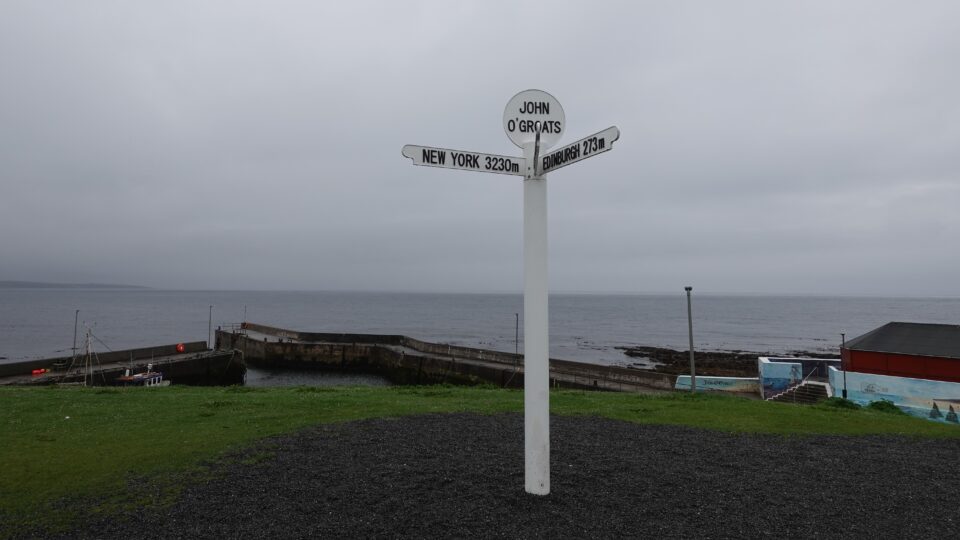
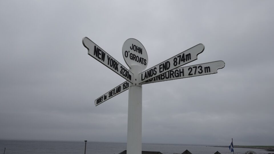
Its most iconic landmark is the John O’Groats signpost in front of the small harbor. The signpost has the distance from here to several known destinations – Edinburgh 273 miles, New York 3230 miles, Orkney 8 miles, Shetland 152 miles and Lands End 874 miles. Orkney and Shetland are British islands north of here and Lands End is the southwest corner of the UK, diagonally across the mainland.
Next to the sign, is another iconic symbol of the town – a white building with several colorful additions. The building’s history is very intertwined with the history of the village. John O’ Groats is named after an entrepreneur called Jan de Groot. The Groat family successfully operated a ferry service from the harbor to Orkney for over 250 years starting in the mid-1400s. They became very well to do and there were eight branches of the family to run the thriving business. Legend has it, that John O’Groats built an 8-sided table for the eight branches, so that no one would sit at the head of the table. Reminiscent of Camelot.
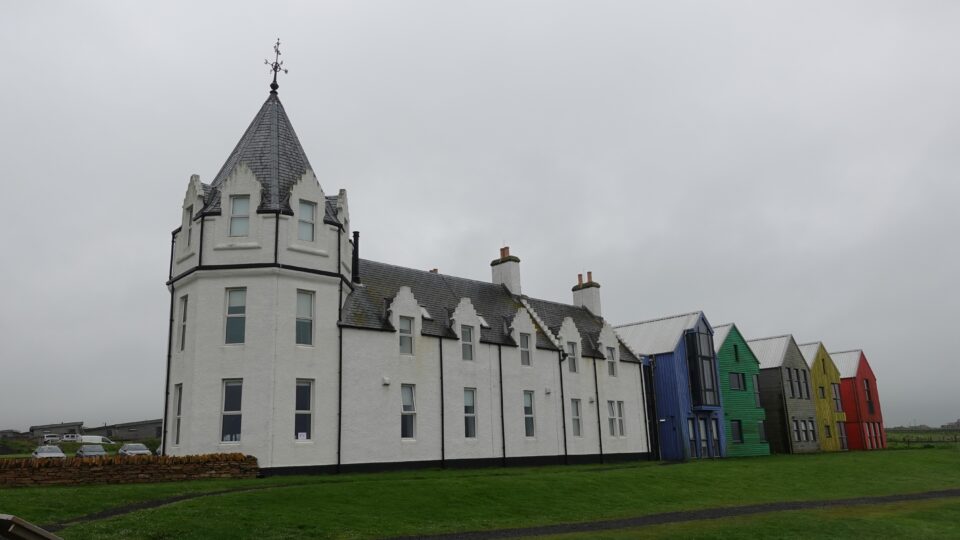
The white building was originally a hotel, which opened in 1875, built with an 8-sided tower to commemorate the octagonal table of Groats. The building stood empty since the 1990s. About 10 years ago, it was renovated and the colorful buildings were added. Today the complex operates as an inn with self-catering apartments.
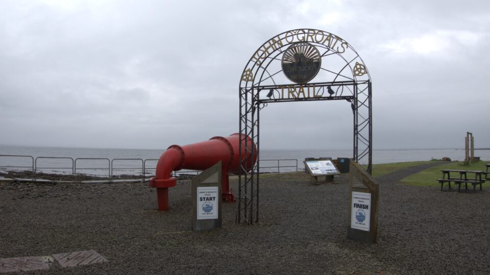
Also near the harbor is an arch indicating the start/finish of the John O’ Groats trail, a 147-mile coastal path for walking between Inverness and John O’ Groats.
Next to the arch is a foghorn. This foghorn was once at the Duncansby Head Lighthouse (the second lighthouse we saw yesterday). Once the lighthouse was automated, it was decided to demolish the lightkeeper’s cottage and the foghorn, that were both in disrepair. Someone from John O’ Groats saved the foghorn from destruction, and eventually it was repaired and placed near the harbor.
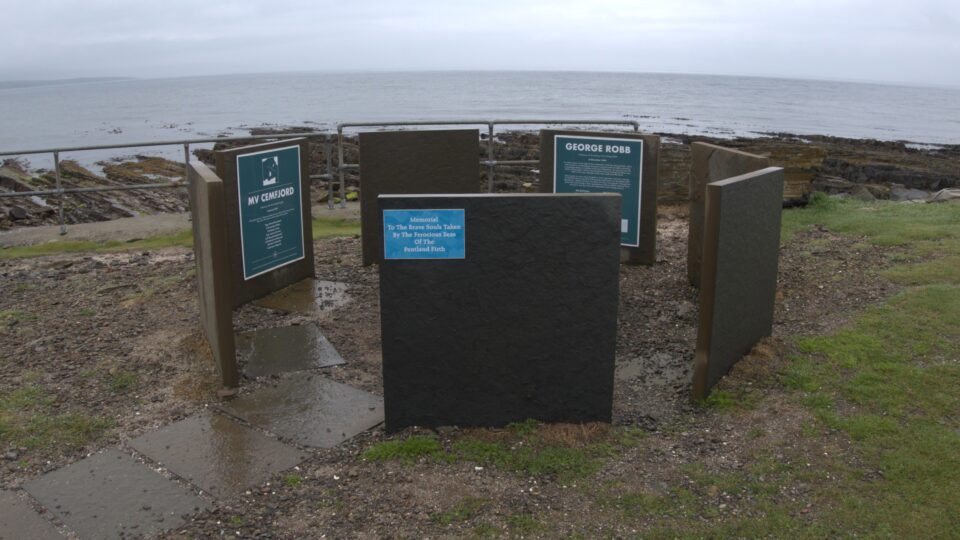
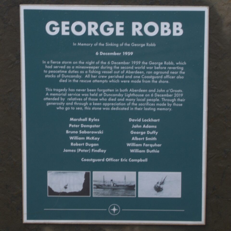
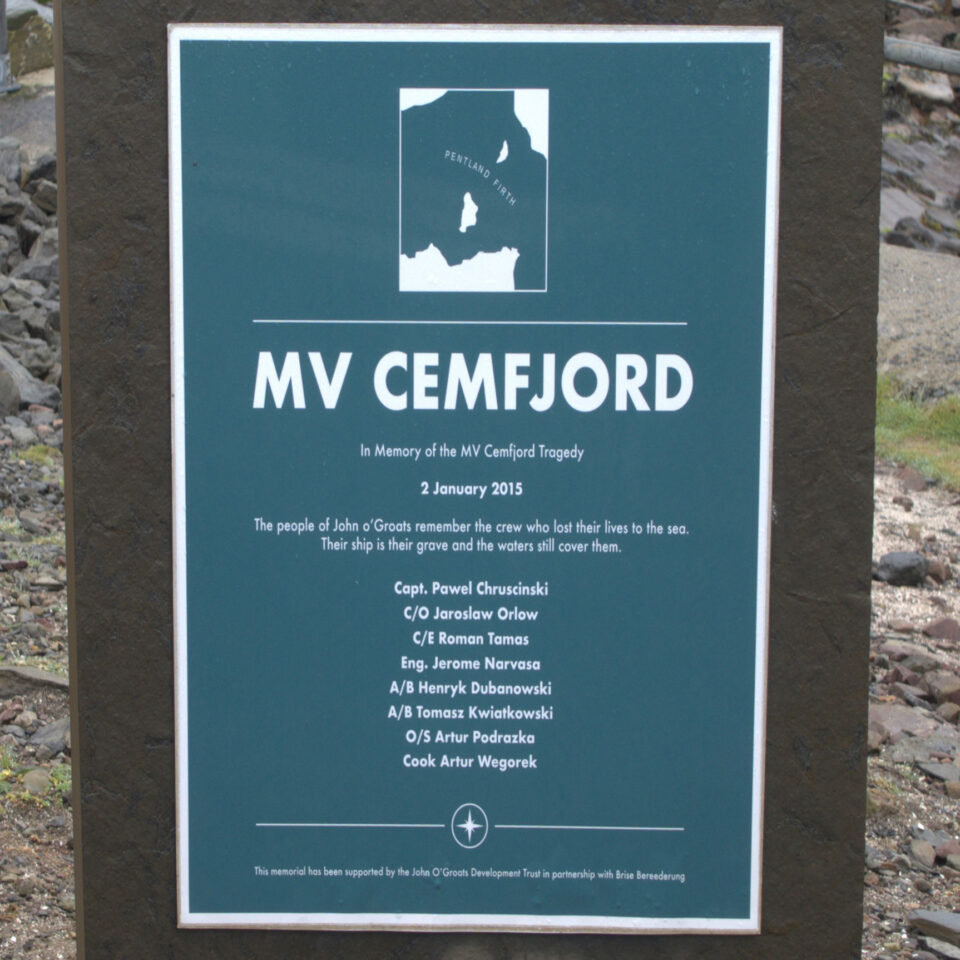
Behind the foghorn, is an 8-sided memorial, to commemorate two of the many ships that were shipwrecked off the coast here. The water between John O’ Groats and the Orkney islands is known as the Pentland Firth. The firth is well known for the strength of its tidal currents, which are among the fastest in the world. Combined with gale-force winds, they often give rise to extremely violent sea conditions. It is considered one of the most dangerous stretches of water in the world. Of the ships commemorated here, one was shipwrecked in 1959 and the other as recently as 2015.
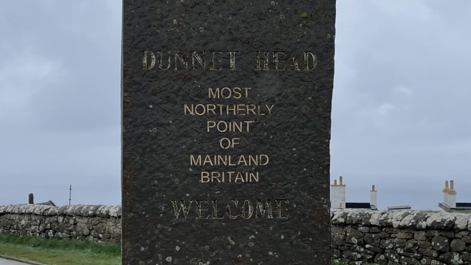
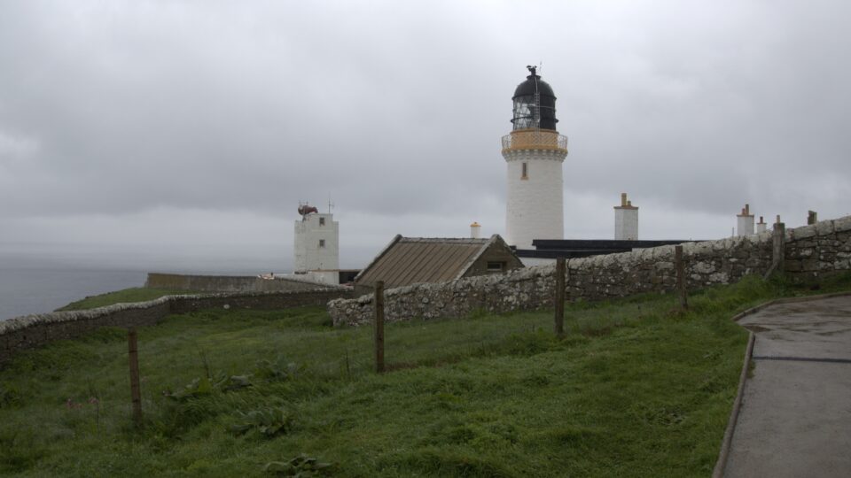
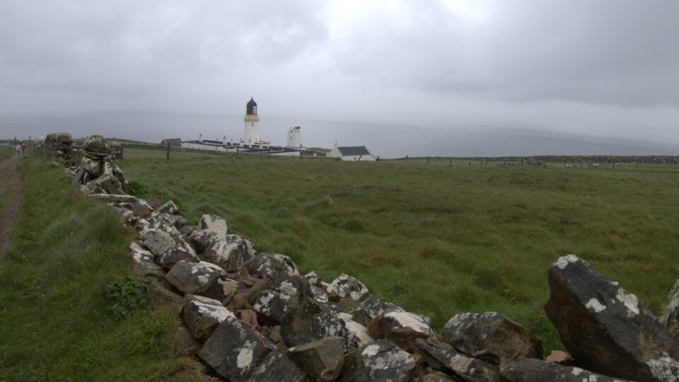
Before heading to the ferry pier, we drove to the Dunnet Head Lighthouse. Dunnet Head is the northern most point in mainland UK, a few miles northwest of John O’ Groats.
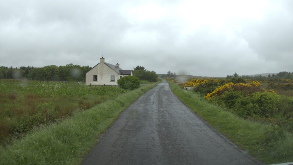
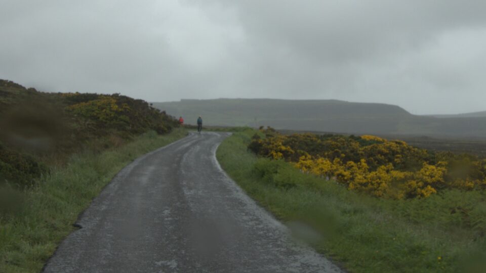
The drive to Dunnet Head was mostly on a one-track road through beautiful scenery. Most drivers stopped at the passing place and waited for us to drive by. We always wave thank you. At one point, as we were driving uphill in the rain, we passed a couple bicycling towards the lighthouse. They looked older than us. Very admirable or very crazy. Not sure which.
On a clear day, you can see the Orkney Islands from Dunnet Head. Today however was not clear. It was now drizzling rain, and the rain was getting stronger.
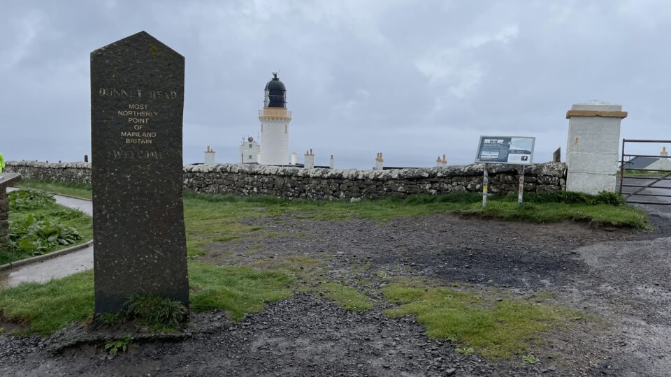
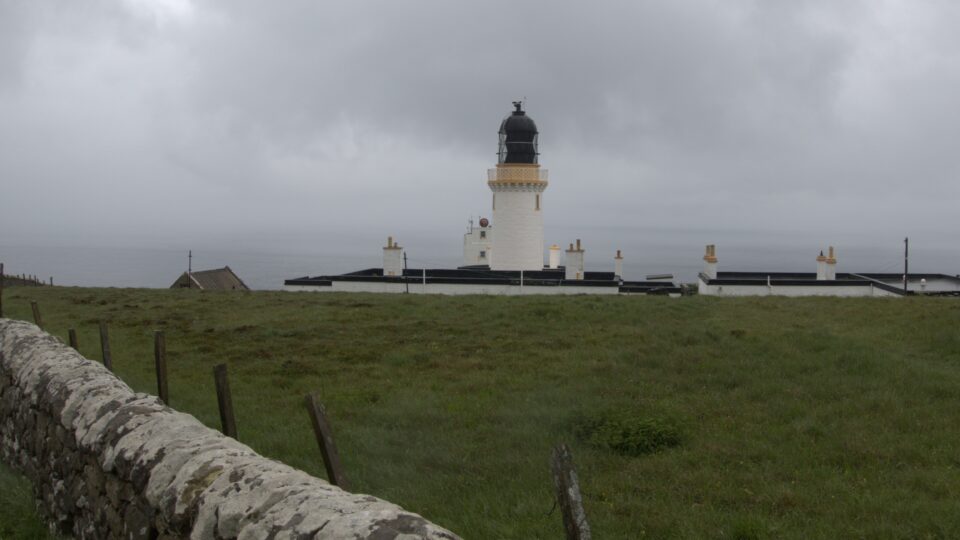
Dunnet Head lighthouse was built by Robert Stevenson in 1831 and automated in 1989. Today the two keeper’s cottages can be rented for holiday stays, or the whole complex can be booked for events such as weddings.
Just as we were leaving, the couple on the bicycle arrived and they took photos of themselves near the signpost.
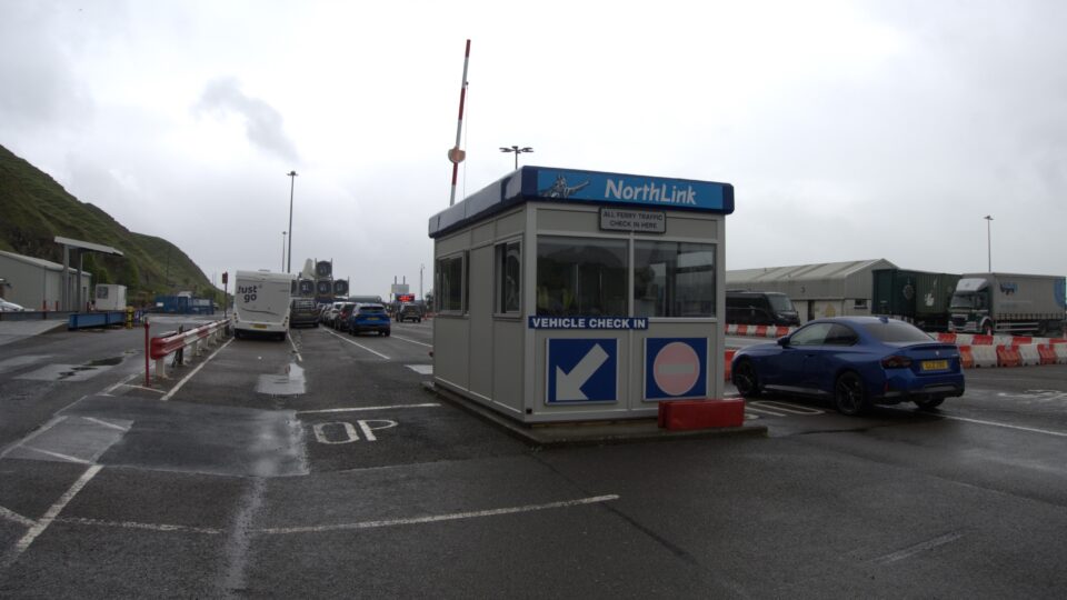
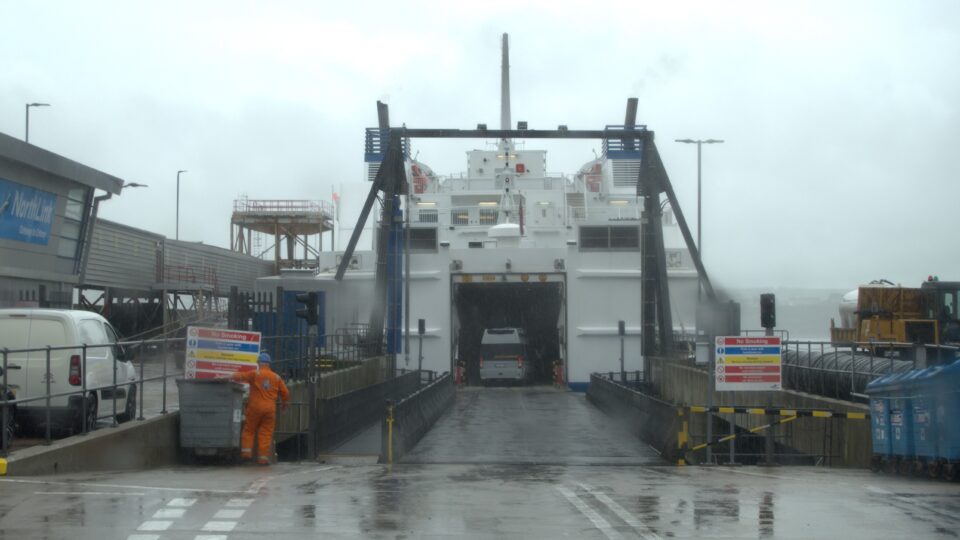
From Dunnet Head we drove through Thurso, the largest town in the area (population 7390 in 2020) to Scrabster, where the ferry terminal is located. We waited our turn to board the ferry. There was rain and more rain.
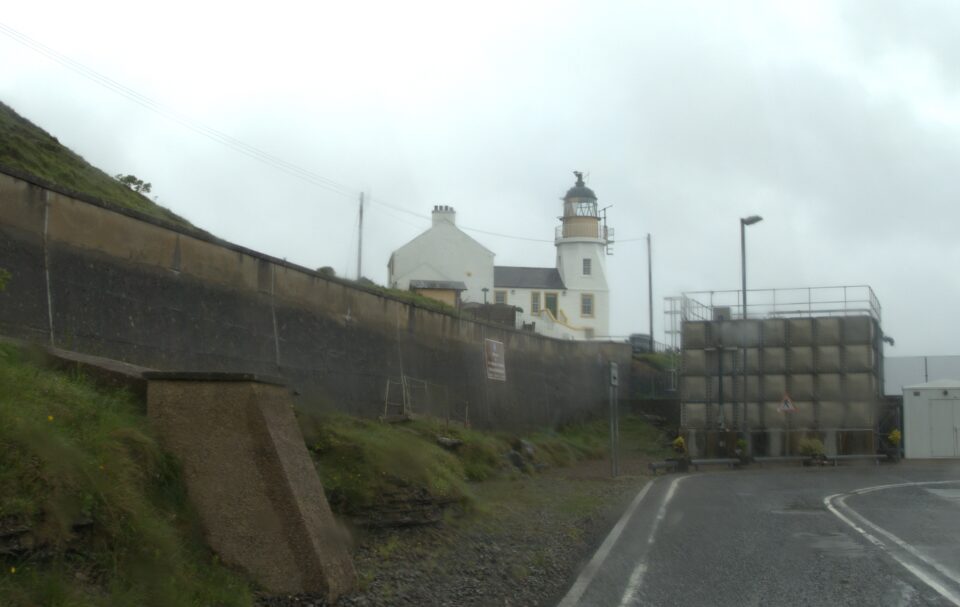
As we were getting on the ferry, we saw a lighthouse next to the terminal. This is the Holburn Head Lighthouse. Designed and built by David and Thomas Stevenson, sons of Robert Stevenson, it was completed in1862. It was put out of commission in 2003, and today it is a private home. Living in what was once a lighthouse seems pretty amazing to me.
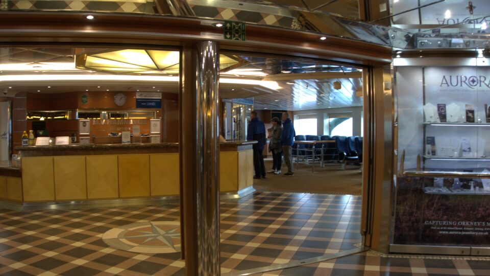
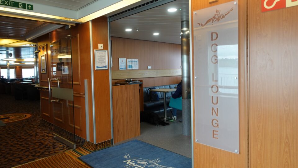
Once on board the ferry, you are not allowed to stay in the motorhome. You need to go upstairs to one of two decks. This was an impressive ferry with a gift shop, several restaurants, an outdoor sun deck and even a dog lounge. For longer trips, there are sleeping cabins to rent.

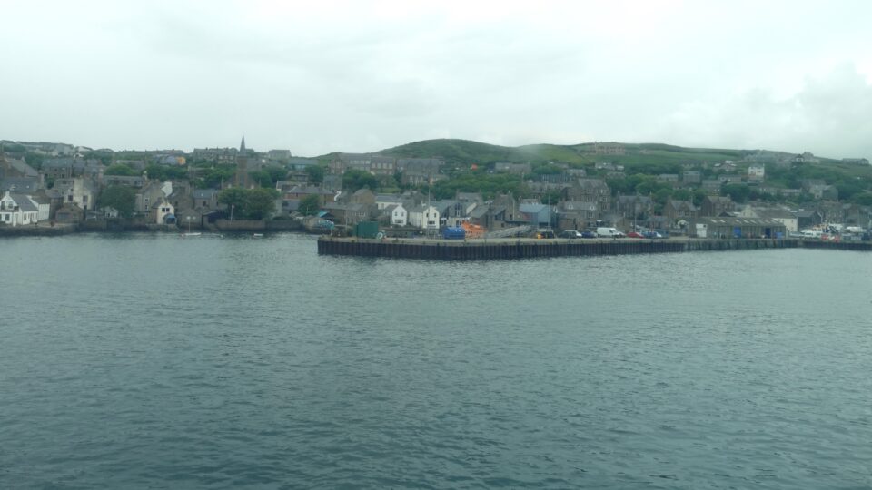
The Orkney Islands is a group of about 70 islands about 10 miles off the northern coast of the UK. Twenty of the islands are inhabited, with a total population of about 22,000. Historically, fishing and agriculture have been the mainstay of Orkney’s economy, with tourism becoming an increasingly important sector. The largest and most populated island is known as the Mainland. The largest cities are Kirkwall, and then Stromness, both on the Mainland.
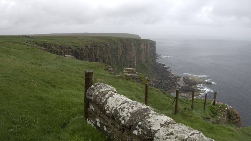
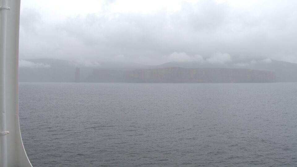
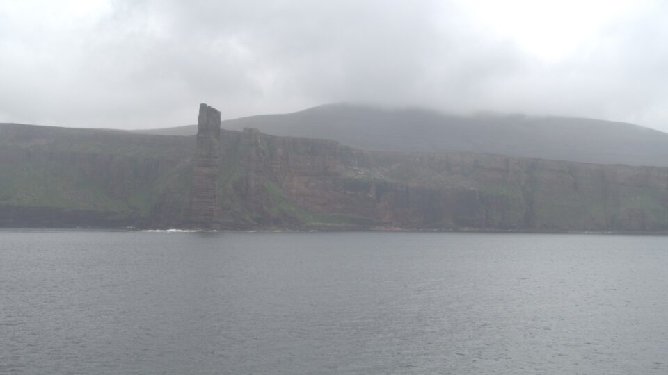
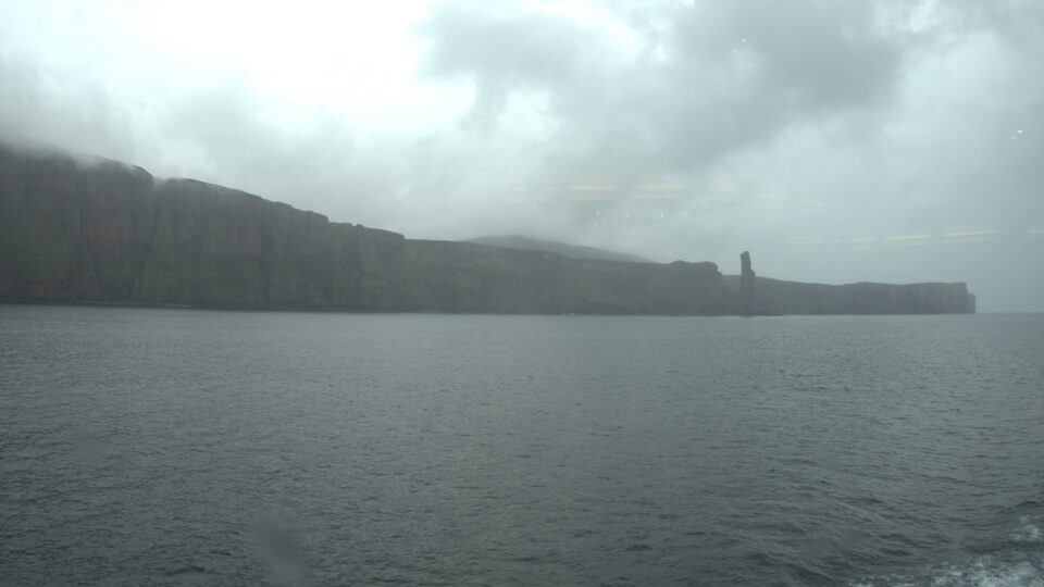
The second largest island is the Isle of Hoy. Its most famous landmark is the Old Man of Hoy, a 137-meter (449-foot) high sea stack. Despite the rain and poor visibility, the sea stack was somewhat visible among the impressive massive cliffs of Hoy. Seeing these tall cliffs I understand why the island was named Hoy, meaning “high island”, by the Vikings,
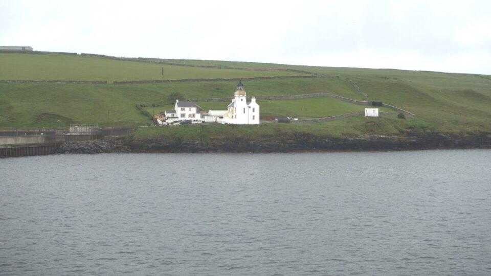
We landed in Stromness, but did not stay there. We would return for Shabbat.

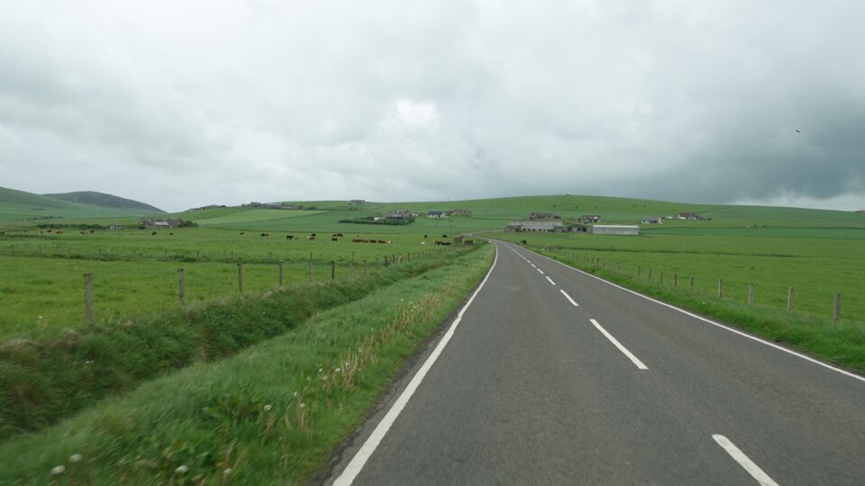
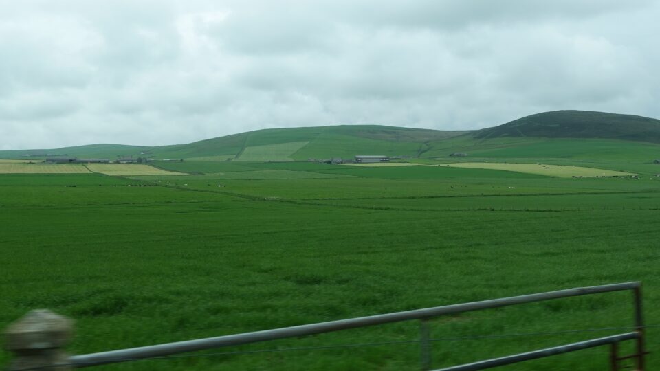
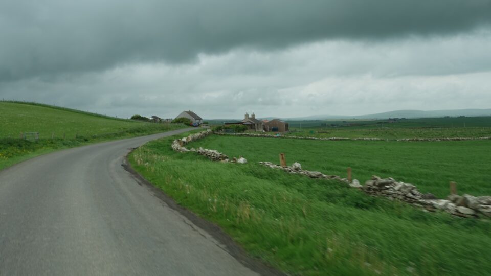
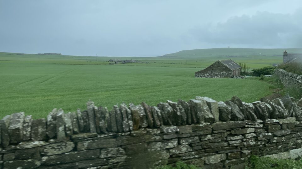
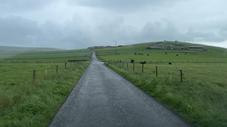
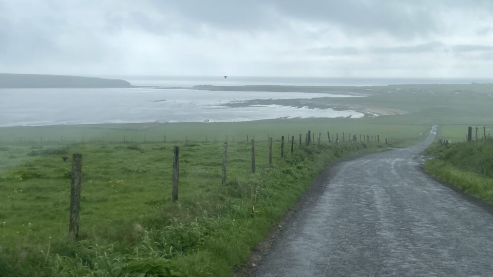
Our first destination on the island was the Skara Brae Prehistoric Village. The drive there, only about 15 minutes away from the ferry (it is a small island) was spectacular. This part of the island is rolling hills, all green, with scattered farmhouses. Many fields with cows and some with sheep, and often marked by stone walls. We passed some lakes and saw glimpses of the coastal shoreline.
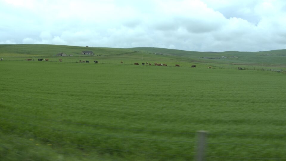
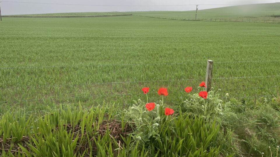
We were also surprised that every once in a while we would see red wildflowers that reminded us of the poppies in Israel.
The road to Skara Brae was empty. We felt we had the place to ourselves. However, when we reached Skara Brae, we saw a parking lot with four coach buses, dozens of cars, and several other motorhomes. We were no longer alone.
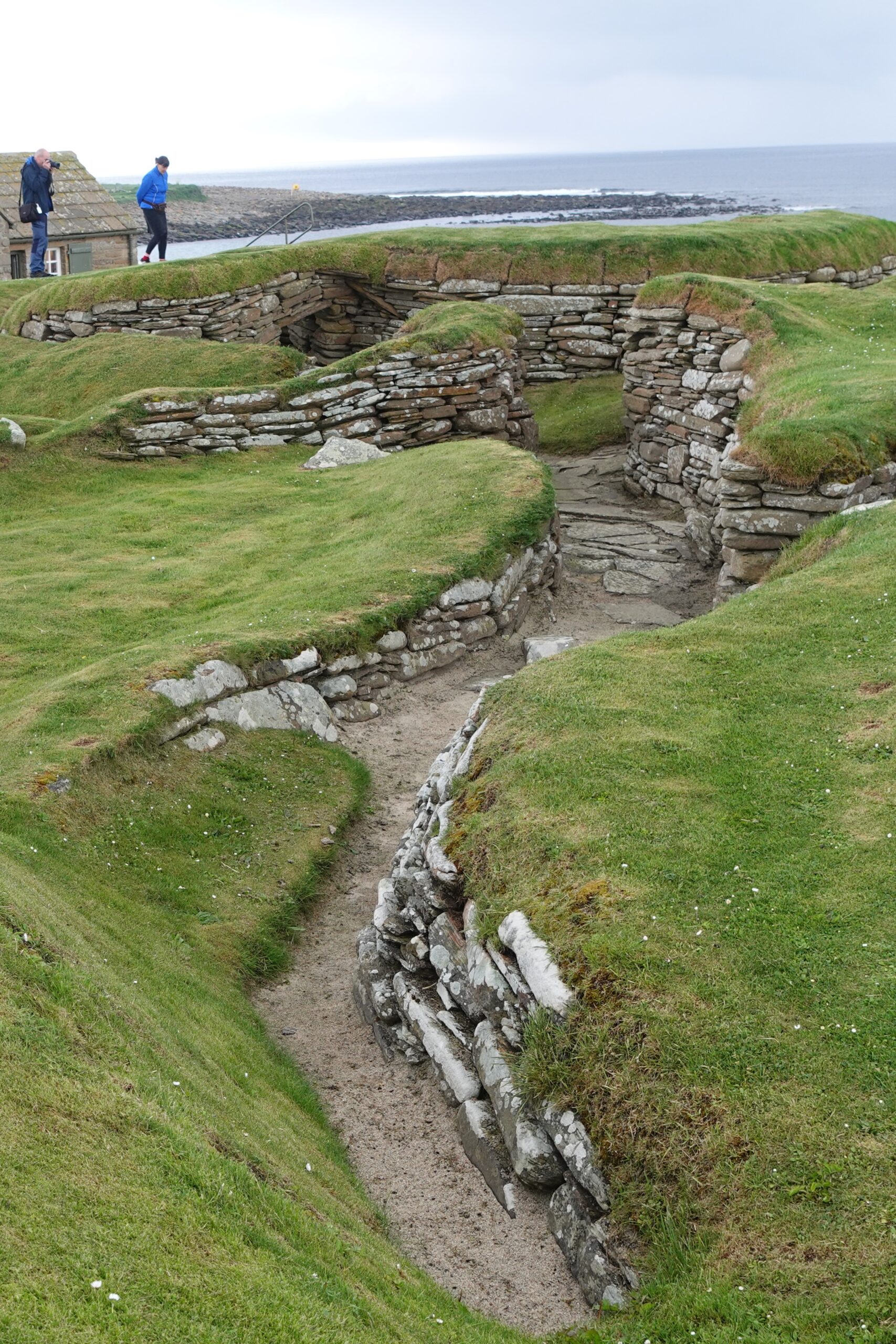
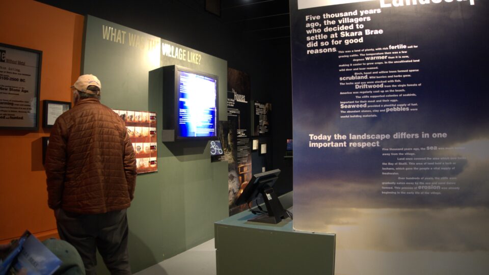
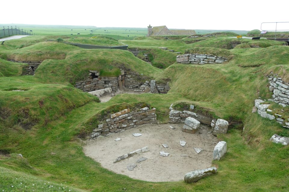
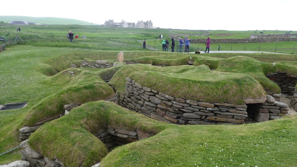
At Skara Brae, we did not really know what to expect. It turned out to be an interesting place. In the introductory movie we learned that in 1850 a huge storm revealed the remains of a Neolithic village under the sand dunes. It is thought that the village is from 5000 years ago, predating Stonehenge, the Pyramids in Egypt, the Ziggurat of Ur in Iraq etc.
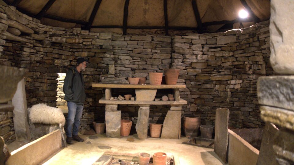
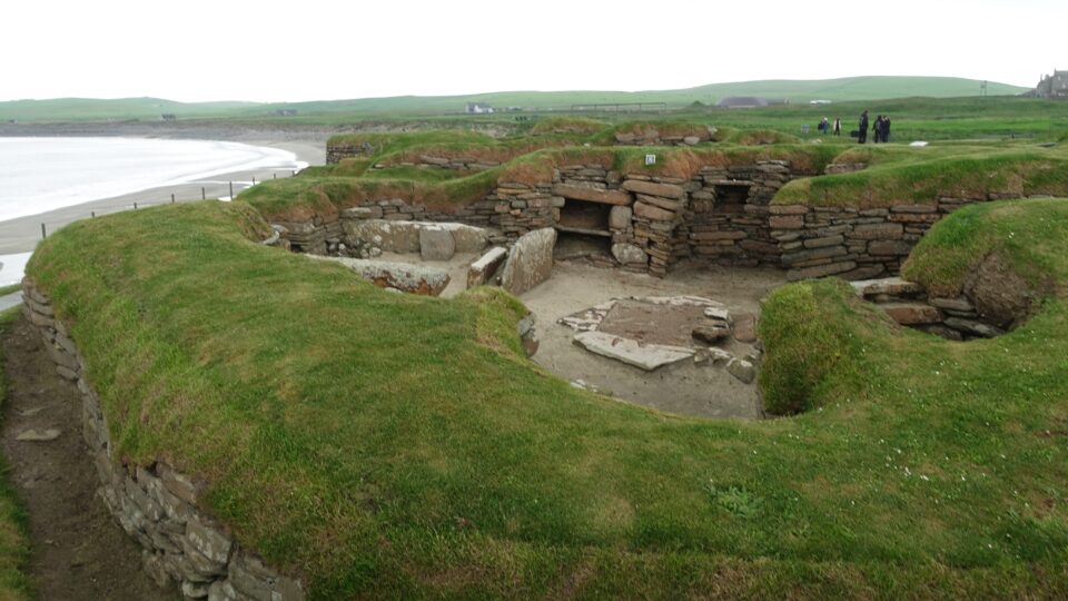
After watching the introductory movie, you enter a detailed exhibit about the village. The village was well preserved because everything was made of stone.
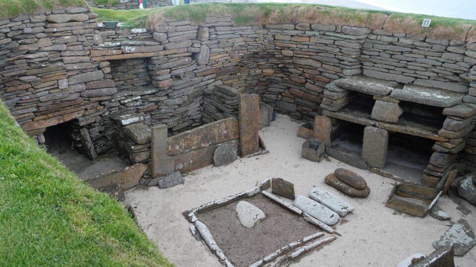
You then visit a reproduction of a typical village house. The houses were circular, built around a central hearth, with beds along the perimeter and shelves to hold the household goods.
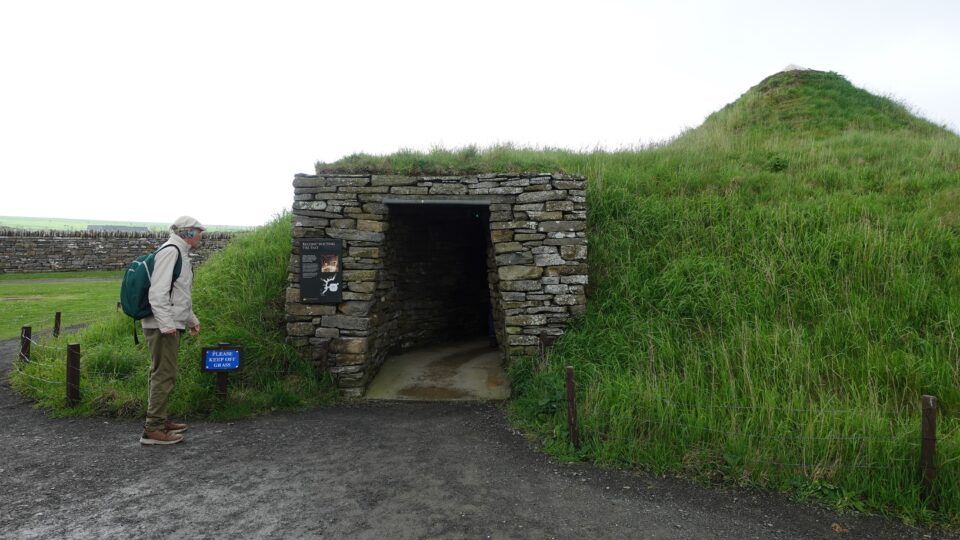
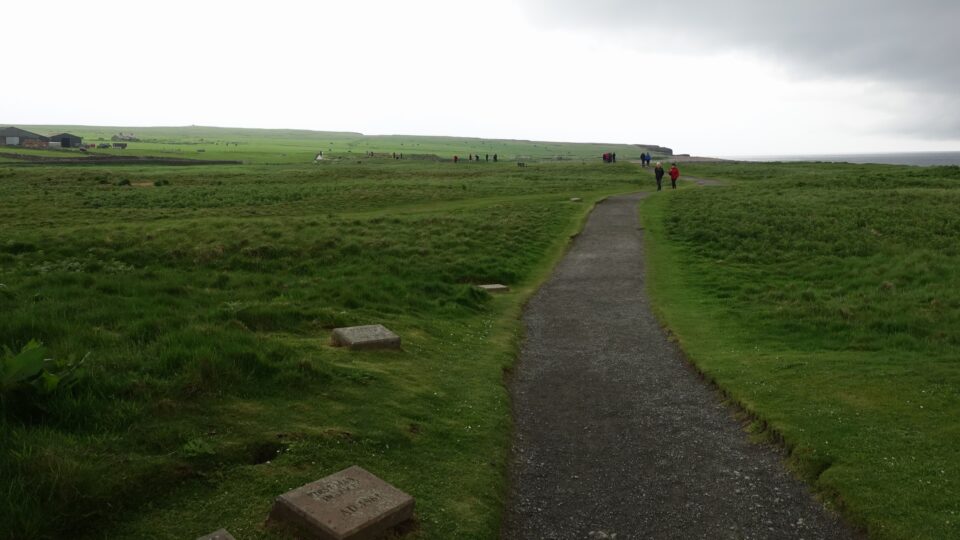
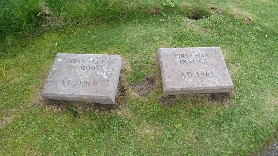
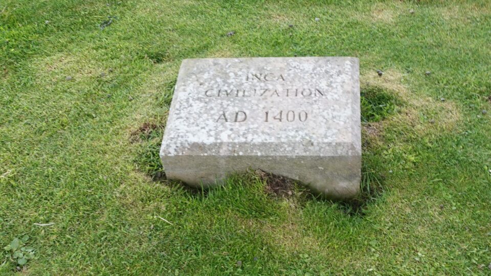
Afterwards, you then follow a path to the actual archeological site. What is interesting about the path, is they turned it into a timeline. Along the way are stones depicting historical events, and the distance between the stones is proportionally equivalent to years. You continue back in time until you reach 3100 BCE, the time of Skara Bara.
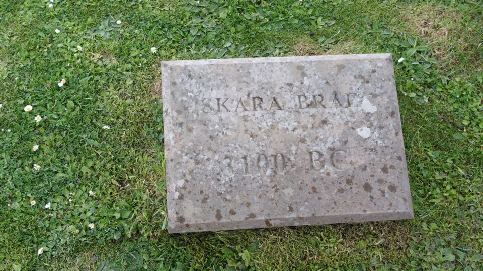
At the site, you follow a path around the stone-built Neolithic village. It consisted of ten clustered houses made of flagstones and earthen dams to provide support for the walls. It is Europe’s most complete Neolithic village and is recognized as a UNESCO World Heritage Site.

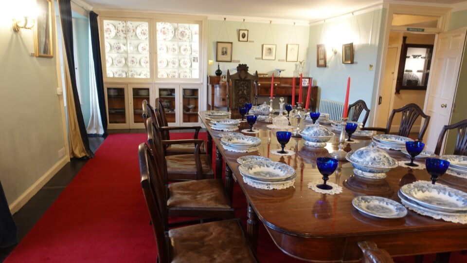
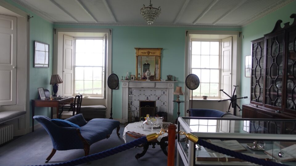
From there, we walked to the Skaill House, a 17th century mansion that became the home of William Graham Watt, the man in charge of the Skara Bara excavations.
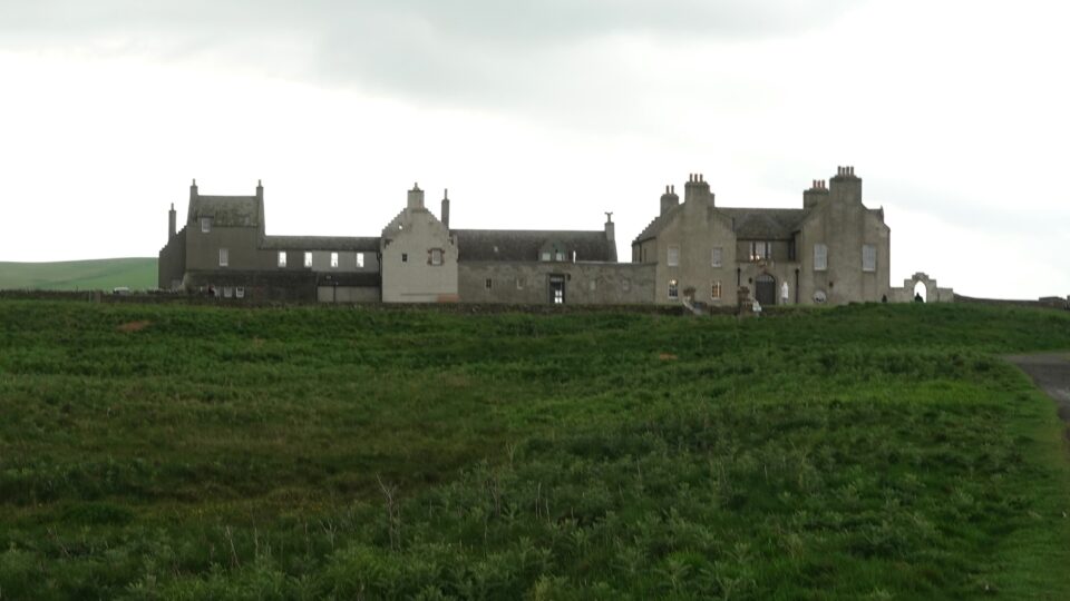
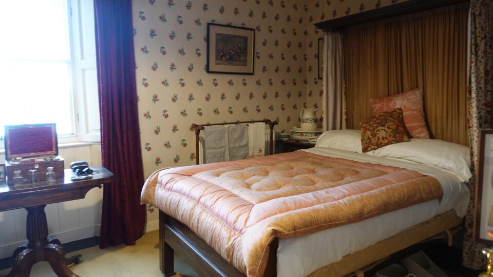
Today the house is supposedly haunted.
After our visit in Skara Brae, we drove to the northwest corner of the island, another 15-minute ride, to our campground for the night.
So far everything has been nice about the Orkneys, except the weather.
Are the stacks natural or man made?
Do we have any neolithic villages in Israel that are that old?